Seattle could see one of its rarest weather feats this weekend: Rain
 Scott Sistek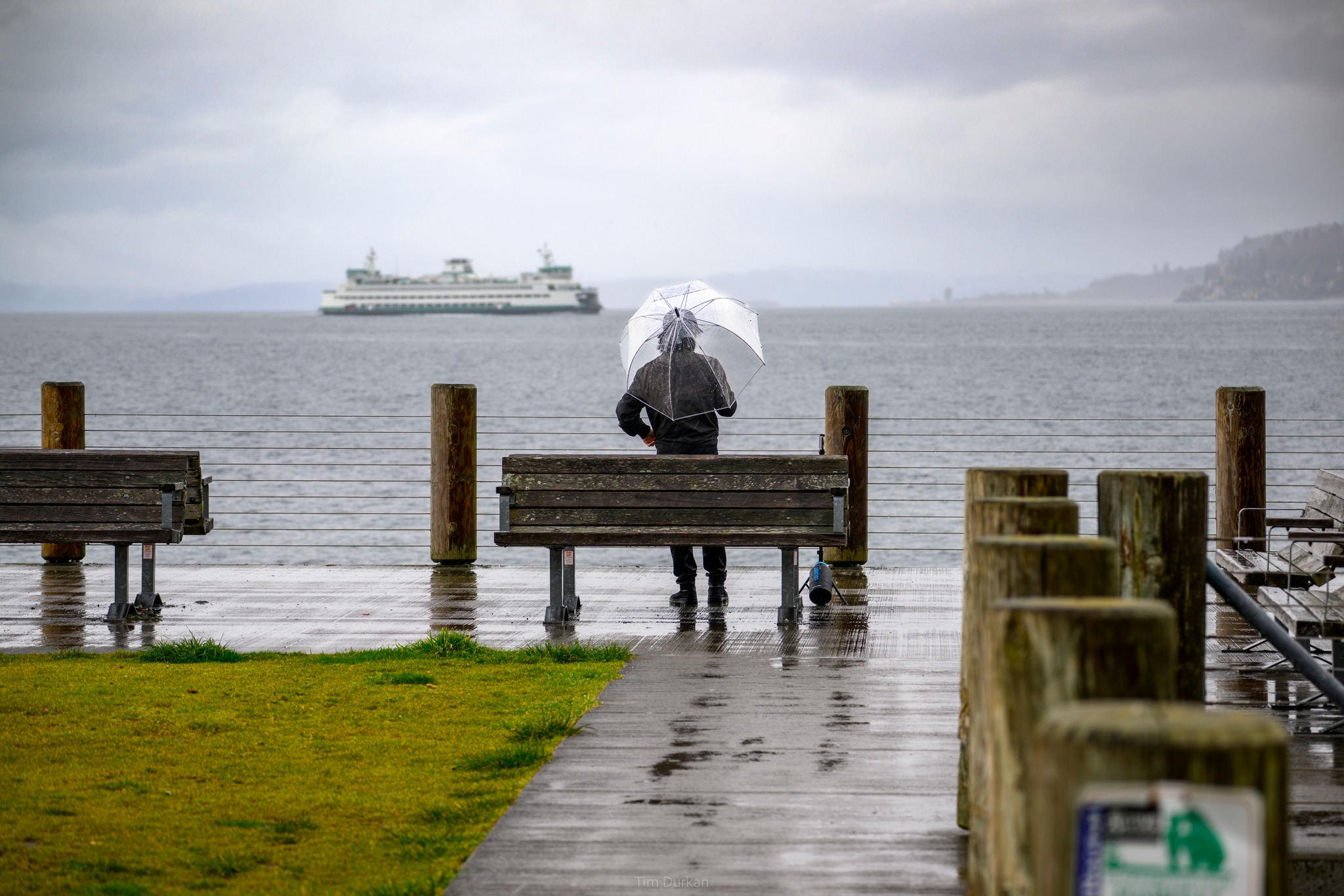
Photo: Tim Durkan
I’ve got a weather riddle for you today: Seattle may experience something so rare this weekend that it’s only happened once in the last 41 years, yet is so common that it’s woven into the fabric of our city’s soul and reputation.
That is, it might rain. On a weekend even.
WEEKEND RAIN IN SEATTLE?!?!? 😱 THAT, LIKE, NEVER HAPP…OH WAIT, WHAT?
The Seattle “Goldilocks” weather may take a brief pause on Saturday. The low pressure center off the coast of B.C. that is going to protect us from the heat dome building in the Southwest is looking like it’ll push into central B.C. this weekend, and as some weather models are now saying its trailing front could nick a chunk of Western Washington on its way inland.
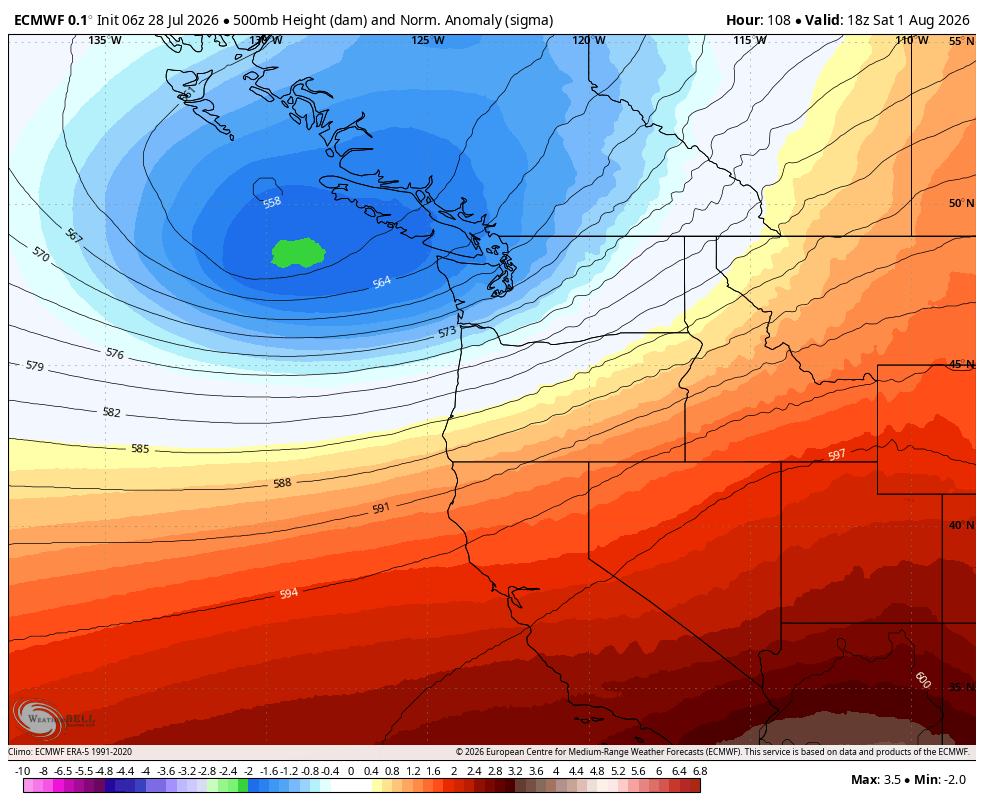
The pattern actually looks somewhat similar to what happened on Sunday with rain along the coast and some showers from about Seattle north with a little rain in the Puget Sound area but not a lot.
The European ensemble models, which run 50 different versions of the main model with slight tweaks to get a better handle on the situation, all agree “some” rain will fall in Seattle and the Puget Sound but the vast majority of them are it’ll be very light rain with consensus average of less than 0.10 inches.
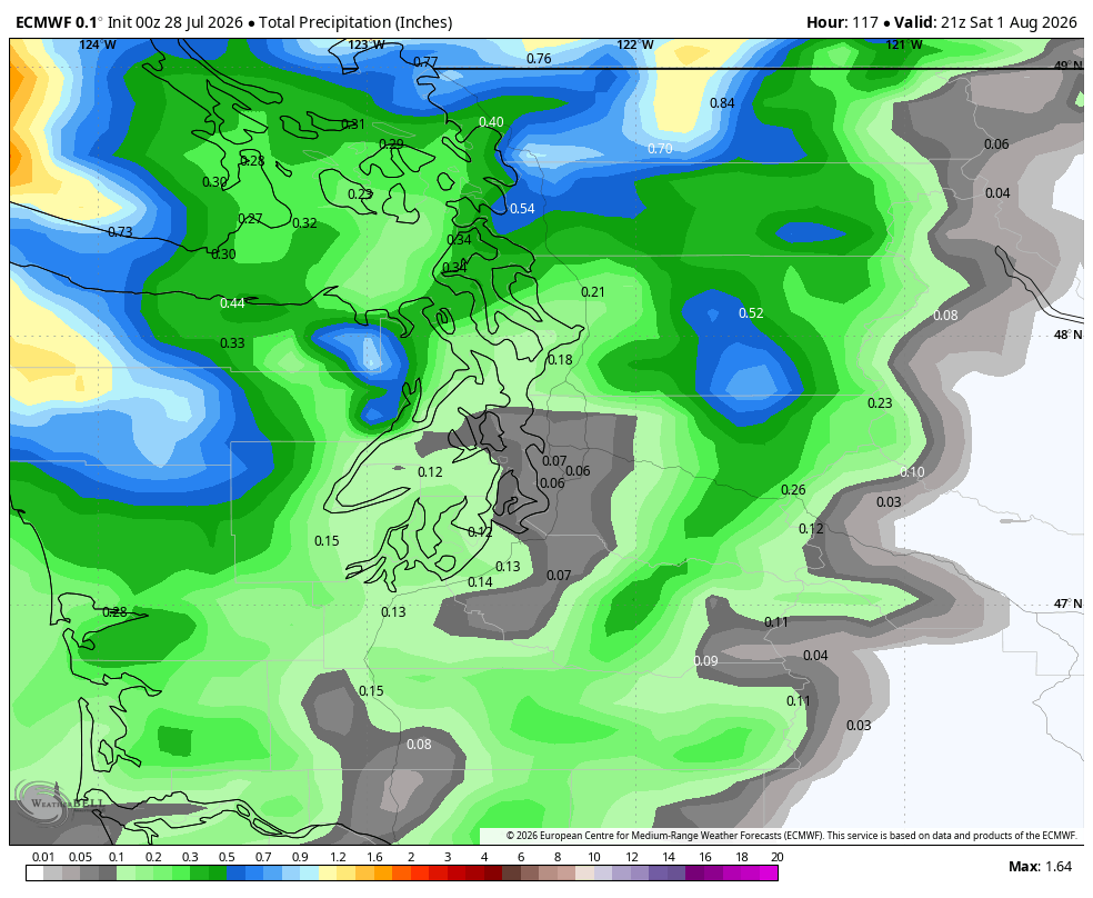
It does look wetter toward Bellingham (~0.25”) and the coast.
THIS SOUNDS LIKE WHAT HAPPENS 9 MONTHS OF THE YEAR HERE?
Yes! But it’s because we’re inside those other three months that make it so rare — particularly THIS weekend — particularly THIS date….
The first weekend in August (and last few days of July) are statistically the driest time of the year in Seattle. August 1st is currently tied for the 2nd driest day in Seattle history (with July 30) with just 10 instances of measurable rain since 1894. Aug. 4 is the “reigning” (not raining) champ at just 8 days of measurable rain since 1894.
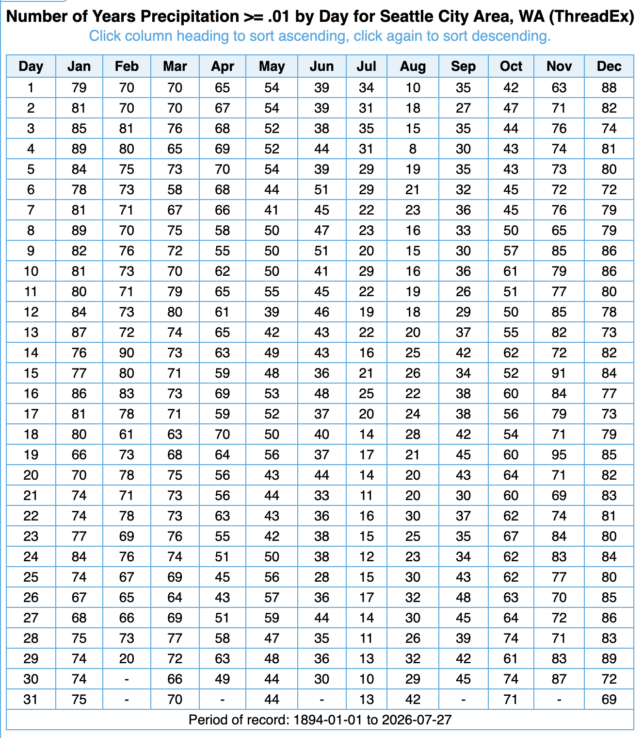
For Aug. 1 though, recent history has been really dry: It has only rained once since 1985 — just 0.06” in 2008.
It’s that nearly guaranteed dry weather why SeaFair schedules its largest events like the hydro races and the Blue Angels/air show for this time of year (how many times do you remember it raining on the hydro races? Yes, I know it’s not zero… but it is rare…) and why if you ask any local popular wedding venues, these are the weekends that book the quickest.
Oops…
The Blue Angels should find some clear skies for their practice runs Thursday and Friday but the weekend main shows may be fighting some low cloud layers, especially Saturday (Sunday’s prospects are a little brighter.)
Showers will taper off Saturday night for most but we may see a weak convergence zone keep some light rain or drizzle in Snohomish County into midday Sunday.
EASTERN WASHINGTON GETS UNWELCOME WIND INSTEAD 😕
The good news is this rain is lightning-free so all beneficial to wetting things down. The Cascades — especially the North Cascades — should get a decent wetting.
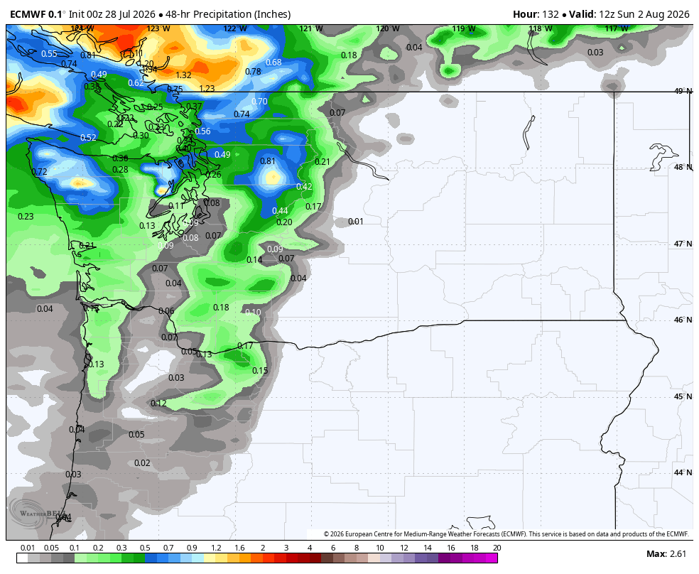
The bad news is unfortunately, Eastern Washington does not look to get in on the rain, which could have helped the wildfires.
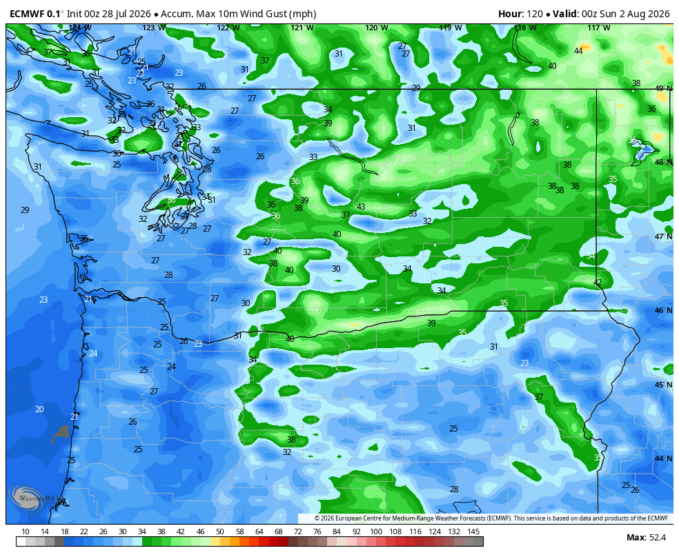
Instead, it’ll be windy but dry and that’s not good for any current or future wildfires.
The National Weather Service in Spokane is warning of possible critical fire conditions in Eastern Washington Saturday, with gusts of 25-45 mph and humidity of 15-20%.
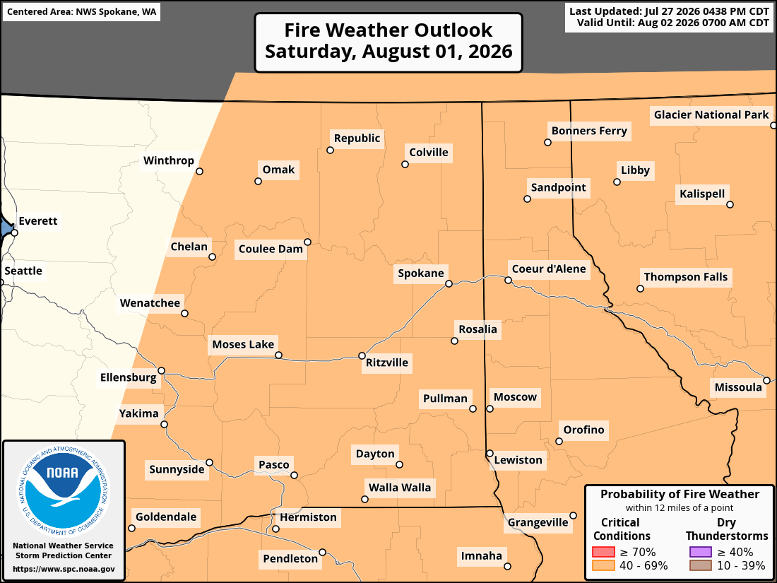
Winds would begin to abate on Sunday.
BACK OUT WEST, GOLDILOCKS COMES BACK NEXT WEEK
Once this system passes by, Seattle looks to resume its pleasant summer streak with sunny days after morning clouds and comfortable temperatures in the 70s next week.
Cross fingers — but at least through mid-August, it’s looking like we may dodge any more big heat days.
As mentioned before, we should be protected from the big heat wave coming later this week to the rest of the West and then the pattern turns more monsoonal and less broiling down there next week.
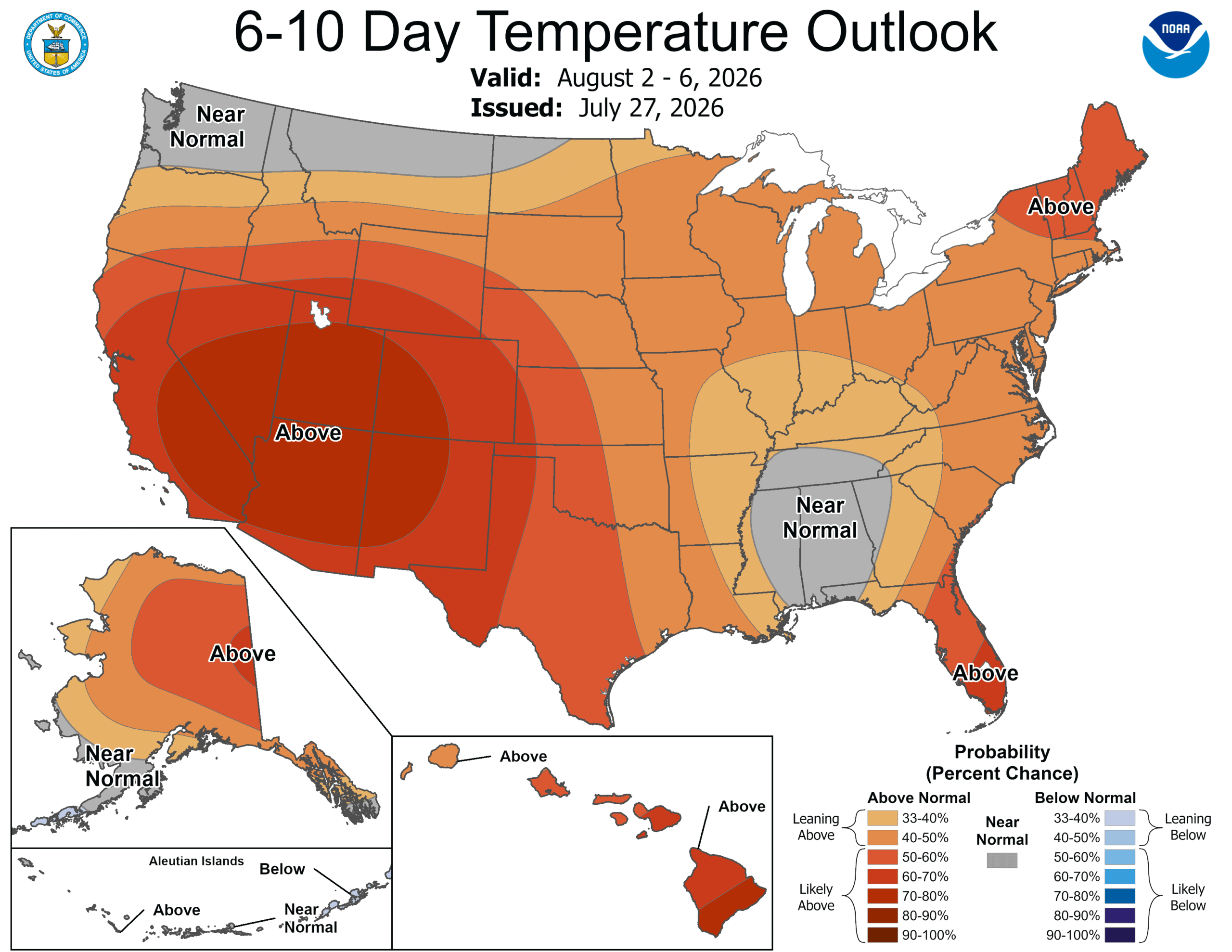
The 6-10 outlook for Western Washington is predicting near normal temperatures.