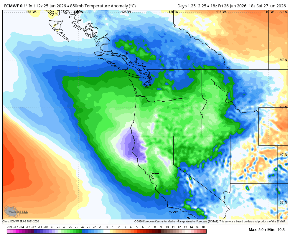
ECMWF 500 mb height anomaly for this weekend (green/blue = colder than average)
It may have been a little bold for the National Weather Service in Seattle to predict a 100% chance of rain in Seattle Thursday night and Friday three days ahead of time with this incoming weather system, but it has indeed officially rained.
Prophecy: Fulfilled.
Now that the rain is here, it’s going to stick around a bit.
Friday will feature occasional light to moderate showers through the day. The latest models sadly aren’t as impressed with the rainfall totals as earlier in the week for the Puget Sound area, giving in to some rainshadowing.
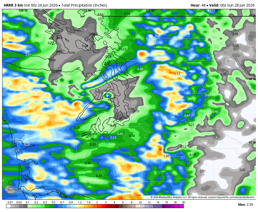
On the other hand, the Convergence Zone areas in the North Sound will likely get extra.
Aside from the rain, it will be relatively chilly with temperatures only in the mid 60s. The cool air will make the air mass a bit unstable and that will bring a slight risk of thunderstorms to the region. Overall, the thunderstorm threat is also not as high as it looked earlier this week (which wasn’t much to begin with) — looks like mostly near the mountains but can’t rule out a few rumbles of thunder even in Seattle.
I do think the World Cup festivities and game at Lum..er…Seattle Stadium will be fine. It’ll be the coldest game of the Seattle slate so far, and there may be periods of light rain but doesn’t look like anything major. Just keep an eye out for a rogue but low-chance thunderstorm.
Showers linger into Saturday though fewer than Friday. Still a very slight risk of a few rumbles of thunder and otherwise staying generally mostly cloudy and cool with highs in the 60s.
Sunday is looking mostly dry but then we stay unsettled into early and middle of next week with a few light and scattered showers amid mostly cloudy skies. Highs will stay in the mid-upper 60s.
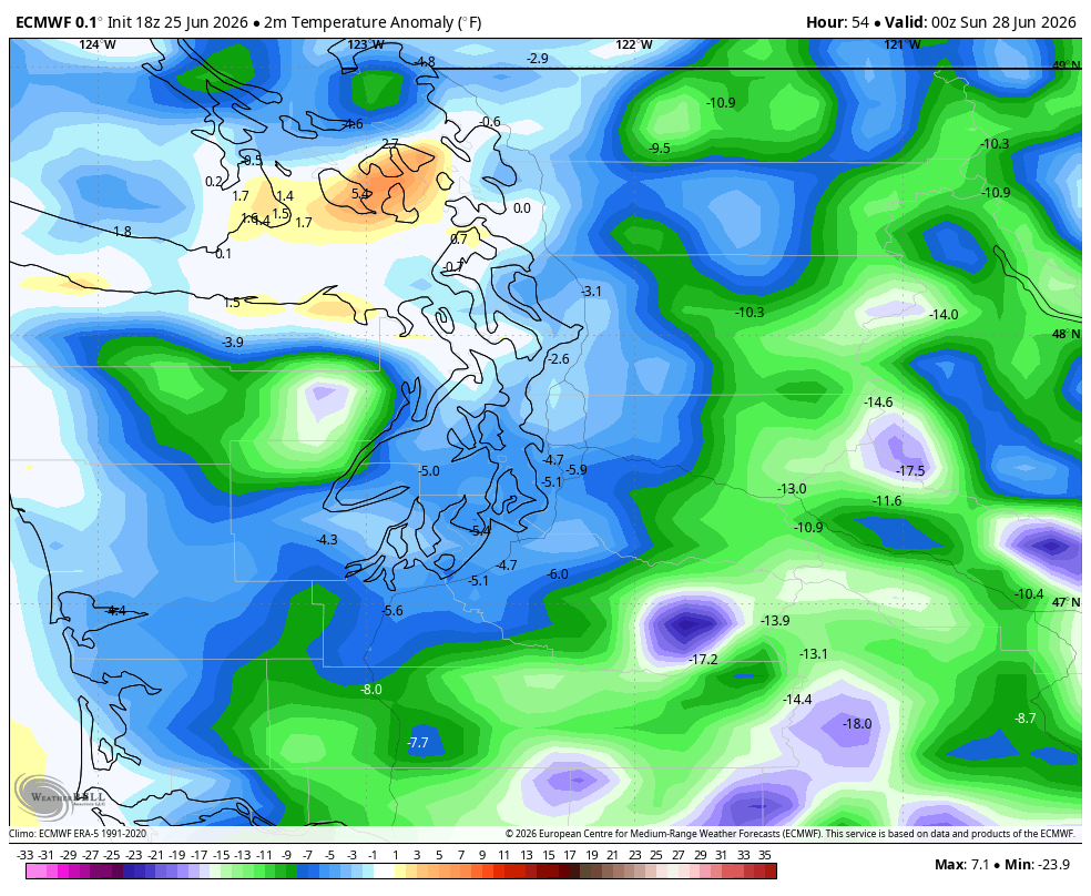
That will be quite remarkable when you consider that will be the 5-year anniversary of the terrible heat wave that saw three days at 100+ in Seattle including the I-still-can’t-believe-108 degree day on June 29, 2021. This time around we’ll be more than 40 degrees colder.
But we’re Seattle, and we can handle a little bit of summer rain. As the National Weather Service in Seattle said today, the forecast had “overall limited sensible weather concerns”. (I guess unless you happen to be the Wicked Witch of the West maybe visiting for the World Cup in which case, bring an umbrella…)
CAN YOU TIE THIS INTO SUPER EL NINO SOMEHOW?
Actually, yes! Sort of. As you’ve probably heard, this El Niño is likely to bring an overall warmer and drier winter. But many meteorologists will stress that it may mean overall that is the case, but that doesn’t preclude other individual short-term events from occurring.
This current weather is a great illustration of what could happen even in a Super El Niño-fueled winter.
Through Wednesday, Seattle was experiencing its 5th-warmest June on record — probably something we’d expect to see in a strong El Niño this winter too. But here we are about to do a week of cool, rainy, and below average temperatures. Even with this cool stretch, with the projected highs the rest of the month we should still finish around 7th or 8th warmest June.
So this winter that’s not to say even if we overall end up very mild and dry… short term patterns could still sneak in a chilly snow event and both these things can be true: It was a very mild and dry winter but hey remember that big snowstorm of (X)?
(What, you want me to predict the date? OK, January 13, 2027. Mark it down.)