La Nina, on its last legs, finally ready to cool things off around Seattle
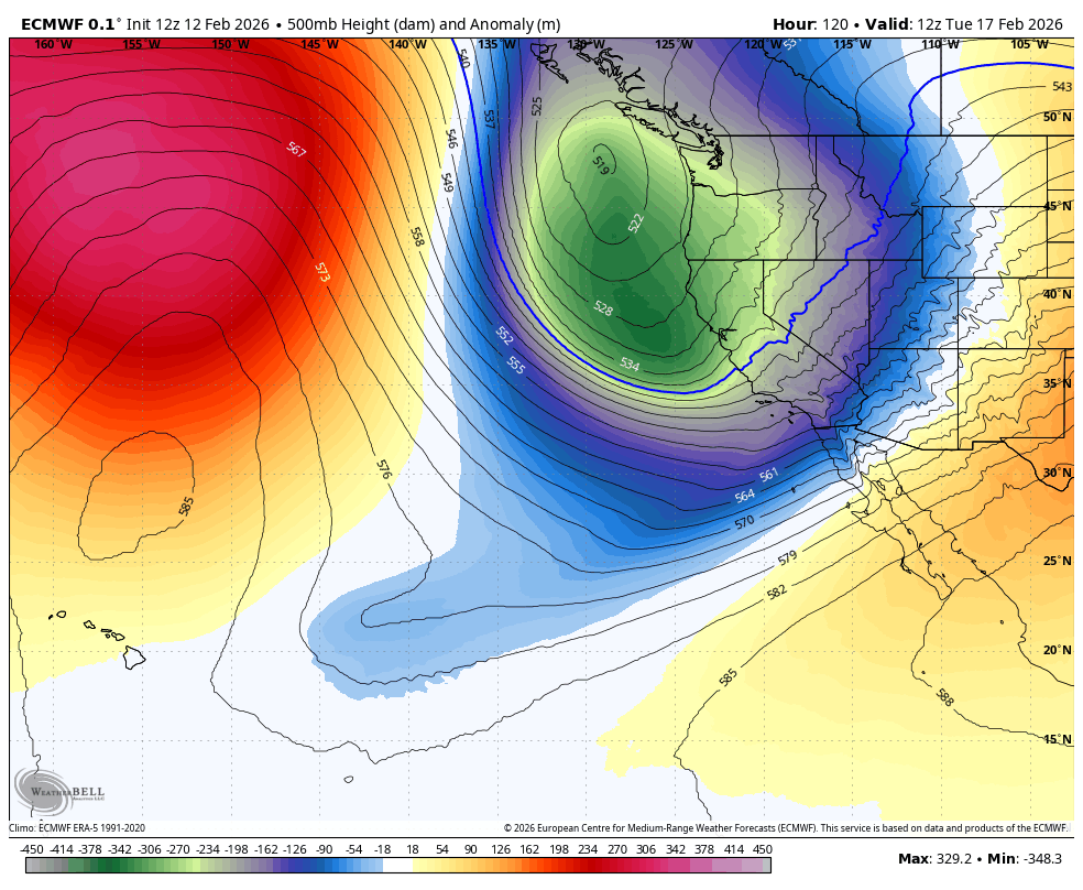
ECMWF model showing 500 mb heights; depicting large upper level trough over the Pacific Northwest on Tuesday.
Well, better late than never, La Niña?
The overwhelming irony that on the day NOAA dished out their monthly update to say La Niña was likely on its last legs and we’re about to slide back into “neutral” conditions, the weather pattern FINALLY for like THE FIRST TIME THIS WINTER is starting to show some La Niña influence, as in bringing a cooler, wetter pattern to the Pacific Northwest.
MORE: La Nina still here, but may not last long. Here is what that means for our winter:
And it might even bring a few snowflakes the lowlands(!) (Though at this point, emphasis on “few”.)
Most of the winter season so far, it’s either been warm and wet or cool and dry, but rarely cool and wet. And the mountain snowpack — usually quite healthy in La Niña years — instead feels as robust as if it were a salad left wilting in the fridge for 14 days*.
(* So I’m told. I’m not sure what a salad really looks like after 14 days — or even 14 minutes, for that matter.)
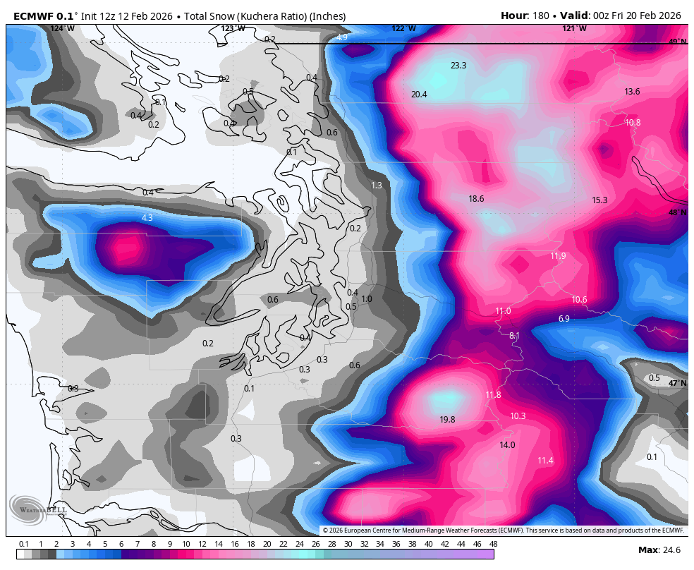
But in just a few short days, the mountain snow machine looks to finally sprout** back to life.
(** Yeah right — don’t really know about sprouts either…)
We’ll get a little appetizer of what’s to come Friday (the 13th! OOOH!) with a weak-to-moderate front swinging through western Washington.
We’ll see light rain at times from about mid-to-late-morning through mid-afternoon around Seattle and the Puget Sound region, with about 3-6” of snow in the mountains. It’ll be a little breezy at times too but while the “date” may be scary, this storm is not.
A few lingering showers will hang around Friday night and through the first part of Saturday with the area drying out by the afternoon.
Sunday looks calm and dry around Seattle as the West Coast weather activity instead picks on California with rain for the Bay Area and SoCal and mountain snow.
It’s Monday when the weather pattern begins to shift up here and winter stops being more than just window dressing***.
(*** Nope, certainly don’t even ask about dressing…)
Our weather systems are now going to be coming out of the northwest from the chilly Gulf of Alaska as opposed to our infamous “atmospheric rivers” that have been coming from the warmer, tropical southwest.
The forecast models are not locked in yet on a consensus on how cold it’ll be and how much moisture will be around, but in the grand scheme of things the pattern is set for more of like “fringey” low-elevation snow events than hinting at any strong arctic blasts or widespread snowstorms.
But it’s this “low-ish snow level” pattern why your weather apps might be occasionally sticking a snowflake icon on the extended forecasts next week when its calculations come up right on the cusp of rain and snow.
Monday will feature a few scattered showers as a trough of low pressure nicks the area, and, yes, it’s possible snow levels *may* be low enough to mix in some snowflakes with the rain showers in the lowlands, but sadly, not cold enough to do much more.
Beyond Monday, a broad tough of low pressure just kinda hangs around the Pacific Northwest for the rest of the week, with perhaps a few nuggets**** of moisture that could also mix in a little snow with the rain.
(**** Nuggets? NOW WE’RE TALKING!!)
Best chances of seeing any snow would be at night or with any showers that get some intensity, but again at this point, it’s not looking like much of any accumulations beyond maybe some grassy surfaces, and showers would be more like Whack-a-mole***** then anything widespread.
(*****- Garden mole: Hard pass. However, chicken mole: Hmmm…)
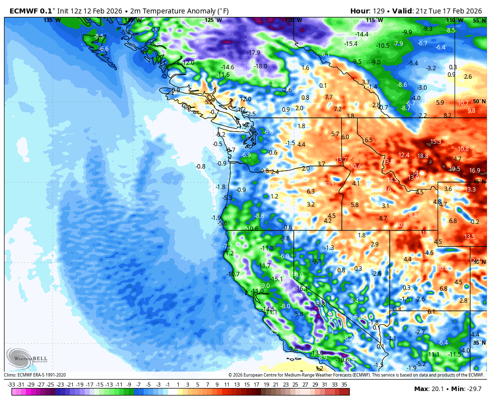
Highs will still reach the low-mid 40s with lows in the low-mid 30s, so again it’s cooler than average and a bit of a winter chill, but so far this isn’t looking like much of a snow deal for the lowlands. However, in the mountains, whatever falls, it’s all snow!
The super long range forecasts do show perhaps some wetter systems toward the end of next week — still coming out of the Gulf of Alaska, so very promising for additional mountain snow. As for lowland snow, the general weather pattern remains cool but snow forecast are far from a piece of cake****** so take any scary snow maps you might see on social media with a grain of salt.*******
(****** YES!)
(******* UM…NO!)