Winter is coming: Seattle’s normal high temperatures begin their descent toward January
 Scott Sistek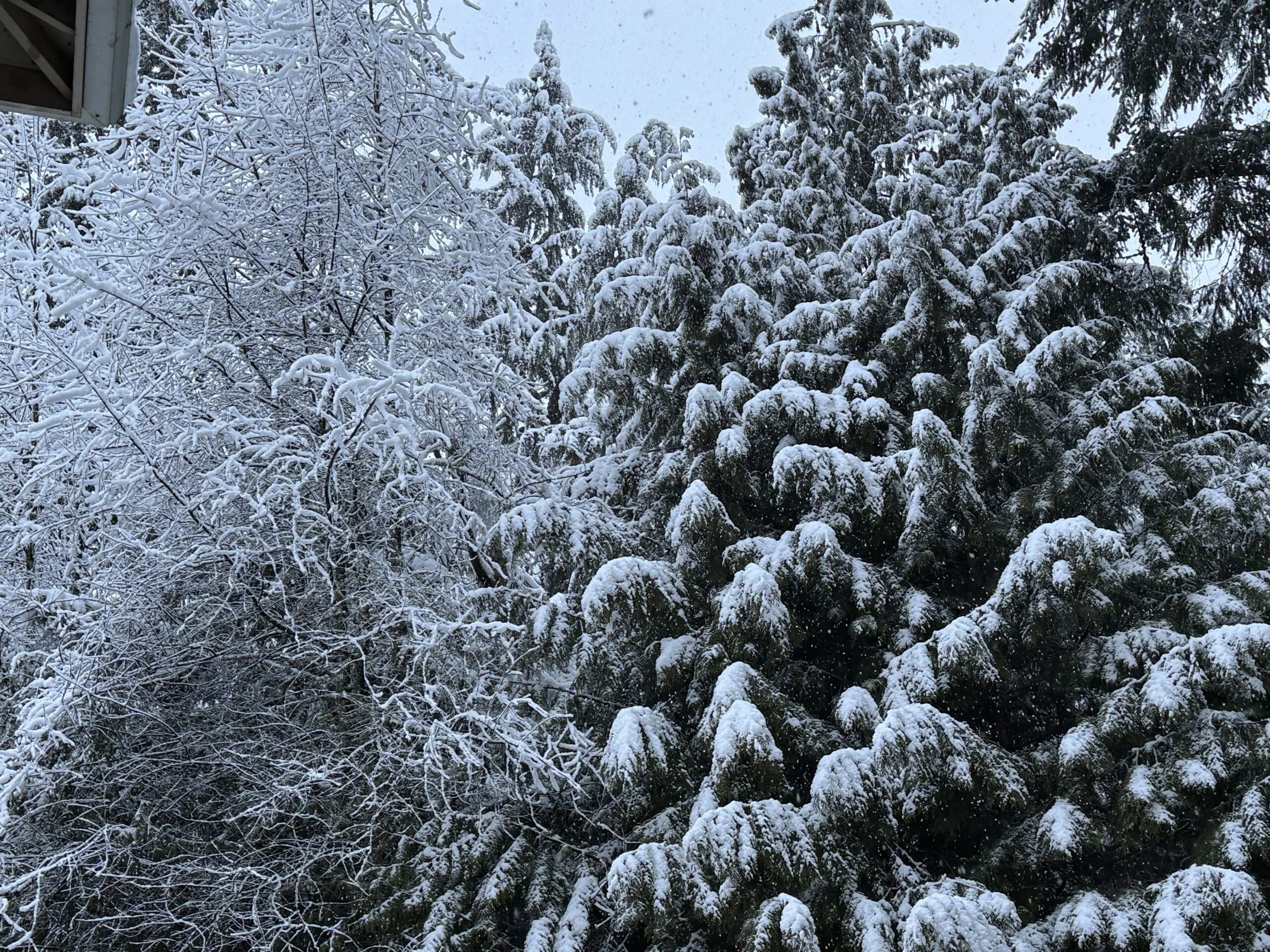
Snow in Mukilteo
With relentless heat and parched land across the Northwest leading to a terrible fire season, you may be ready for autumn to hurry up and get here.
Well, we’re still several weeks away from fall and months from a comforting winter chill. But Monday marks an important milestone on the journey.
The normal high temperature on Monday, August 10th for Seattle is 78 degrees. What’s so special about that? Sunday, it was 79.
WE’VE STARTED OUR DESCENT INTO WINTER!
(*At least “started” in the climate books, which round to the whole number, on August 10. Technically, we dropped from 79.0 to 78.9 on Aug. 2, but it still reads “79” in the book until we reach 78.4, which happens on August 10.)
First, we already lost our post 9 p.m sunsets. We then passed the driest weekend of the year at the first of August. Now, the slow but steady drop in average temperatures is under way! Next up: Spiders, then leaf changing! Woo!*
Helloooooo marine layer. Feels pretty nice out there doesn’t it? Looking for a high temperature in Seattle today a couple degrees below normal.
Today begins the slow daily descent of average high temperature toward winter.
Photo courtesy @space_needle.#wawx pic.twitter.com/nJQVpOZFbf
— NWS Seattle (@NWSSeattle) August 10, 2026
(*-OK I know many other spots around the country have WAY hotter summers than we do, and a lot of people in the Northwest actually LIKE the heat, especially Seattle’s relatively tame, humid-free version of it. You have all been acknowledged…now, us rain fans will get back to cheering summer’s eventual demise 😉 )
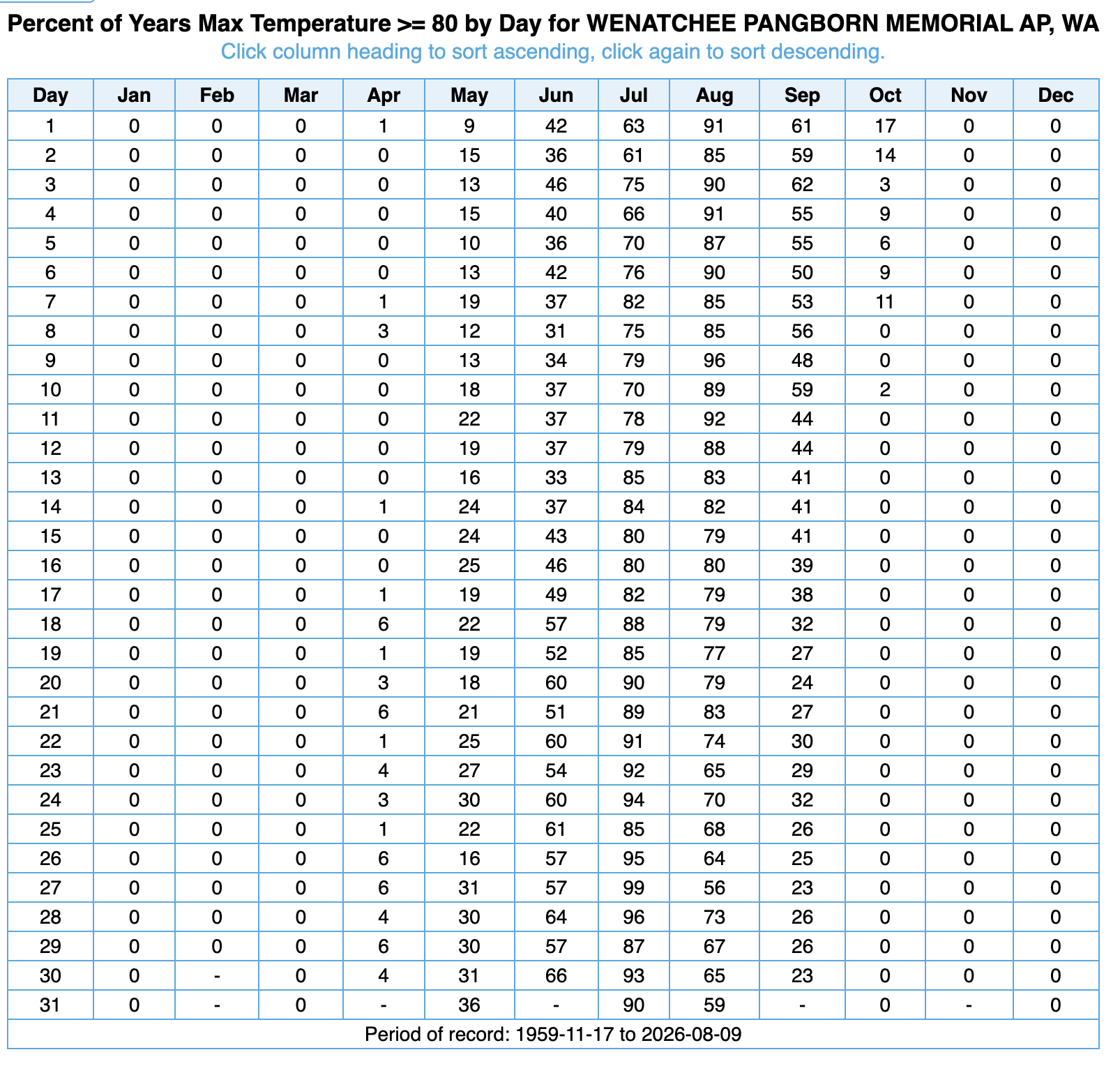
For the summer fans out there, do know you’ve got plenty of time left. Seattle can hit 80 degrees with some regularity as late as Sept. 15, and can reach 80 on occasion as late as early October. Spokane and Wenatchee are pretty good for 80s through the end of September.

(Wenatchee has an interesting statistic: About 25% of the time it’ll reach 80 degrees on Sept. 30. By October 8, that number is 0.)
But while the descent is gradual now, it’ll accelerate as we get closer and into autumn. Seattle and the Northwest are a bit strange in their climate in that the climb from spring to summer is very gradual but there is a rapid transition from summer to fall (because the jet stream “quickly” drops down from Alaska and B.C. in late summer and early fall.)
For example, it takes 99 days go from Seattle’s normal** high of 60 to 79 (April 20-July 28) but only 76 days to go in reverse (Aug. 2-Oct. 17) from 79 degrees to 60 degrees — nearly a month faster.
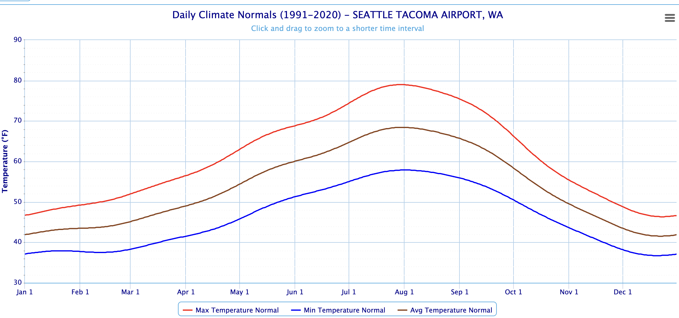
(**WARNING: MATH AHEAD — Feel free to skip this paragraph if you didn’t sign up for a math lesson: These numbers we’re talking about are “normal” not “average” highs due to statistical processing. An average high would simply be, for example, take August 10th’s observed high temperatures, add them all up and divide by the number of years. In that sense an average high might not be a smooth curve. It might be 78.9 on the 8th, 78.4 on the 9th, 79.2 on the 10th, 77.9 on the 11th, etc. We then apply a statistical “normalized curve” process to smooth out the curve to a gradual up and down. So the books would read a week’s of normal highs as 77, 78, 78, 78, 79, 79, etc.)
** DONE WITH THE MATH; YOU CAN COME BACK NOW…**
OK I may have lied. There may be a tiny bit more math to announce:
THESE WILL LIKELY BE THE FINAL 5 SUMMERS IN OUR LIFETIME SEATTLE DOESN’T HAVE AN 80 DEGREE NORMAL HIGH!
The official stats used in the National Weather Service climate page run on 30-year averages that update every 10 years. Right now, we are using the averages from 1991-2020.
Way back when I began my career when they were using the 1961-1990 averages and “weather app” meant “What kind of food do you want to snack on at the outdoor BBQ before the main course?”, Seattle’s hottest summer normal high was 77.
It’s been creeping up with each update. Now we have 79 as our peak normal summer high.
But in 2031 when the data updates to using the 2001-2030 averages, I suspect Seattle will EASILY have an 80 degree normal high, if not an 81. The average summer (June 1-August 31) high temperature from so far in the 2020s is 2.5 degrees warmer than it was in the 1990s— and 2.5 degrees is a big number when talking about long term average temperatures.
Put another way, Seattle used to only average 25 days of 80+ degrees a year. Now it’s going to be the expected high for some period of summer.
But winter is coming.
Slowly.