What is a Kelvin wave? Why Seattle shouldn’t need to worry much about El Niño’s sidekick
 Scott Sistek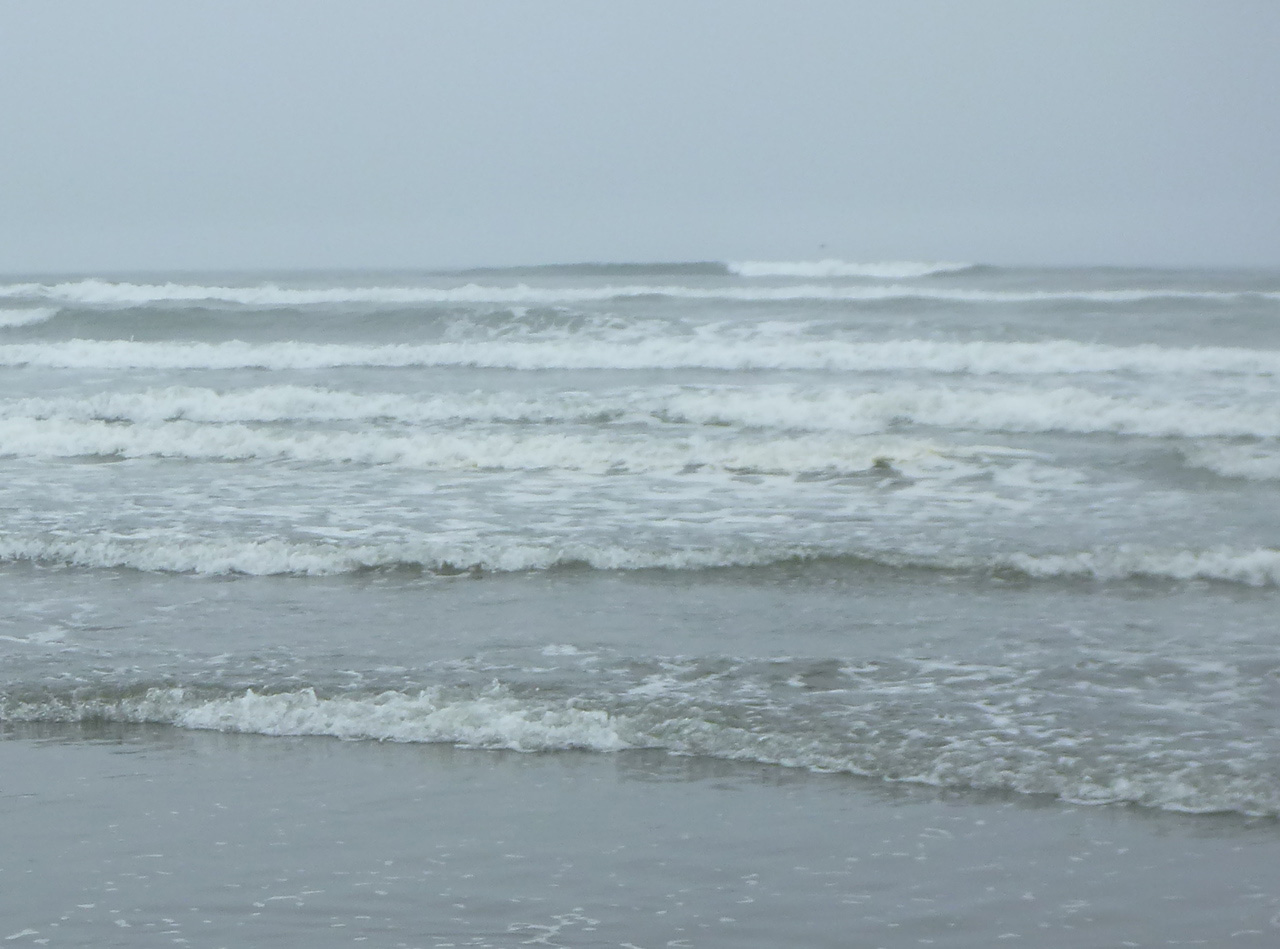
Oregon Coast Waves
Super El Niño now has a sidekick, and its name is Kelvin. If you haven’t heard, he has a wave named after him, though it’s hard to ignore since it’s supercharging social media feeds. (So, here’s another post!)
Kelvin Waves had been a slow murmur in the background as Super El Niño grabbed more and more headlines over the past several months, but now is suddenly finding itself thrust to a co-starring role in the media as its effects begin to reach American shores — specifically the Southern California shores to start, though it’ll eventually work its way up here into the Pacific Northwest.
Let’s start with maybe the most important question you might have when hearing about a Kelvin Wave:
DO I NEED TO BE REALLY WORRIED ABOUT IT AROUND HERE?
Short answer: No
Longer answer: Nooooooooo
Even longer answer: Read on…
WHAT IS A KELVIN WAVE?
First of all, with all the breathless headlines around it, let’s start with what it is NOT: A big massive tsunami or incoming wave straight out the movie Deep Impact.
Instead, Kelvin waves are slow moving “blobs” of warm water that can raise sea levels a few inches for an extended period. That means they are essentially unnoticeable — you’re not going to notice when it arrives or when it leaves, even if you were standing at the beach at Ocean Shores with your toes in the surf.
(In this sense, “wave”, while an accurate description of the event, is probably a poor description for public visualization as it’s not like the visual waves we see at the beach. )
WHAT MAKES A KELVIN WAVE?
The part about Kelvin Waves being a “sidekick” to Super El Niño is true — this event; they are going hand in hand. But first we need a quick note on El Nino’s main role:
El Niños begin when trade winds near the Pacific Ocean that normally blow east to west, break down. And in strong El Niño events like this current one, they even reverse direction at times and blow from the west.
That trade wind engine, which usually helps push warmer waters across the ocean toward the west, instead pushes that warm water into reverse to the east, where it eventually crashes into the western South American coastline.
To visualize what happens next, imagine you have a water balloon filled with warm water. Now imagine you hurled it at a wall (IMAGINE! Don’t really do this… unless you want a big mess to clean up.). When the balloon hits the wall and goes splat, warm water rushes out along the wall in all directions.
Now, instead of that happening over fractions of a second, imagine that process slowly occurring over weeks and months. The warm waters beneath the surface “crash” in slow motion into the South American coastline near Peru and Ecuador making two Kelvin waves and have then been very slowly rolling south and north.
The northern wave went first along the South American coast, then Central America, and western Mexico.
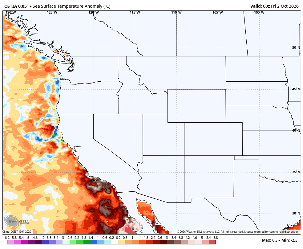
The process has been underway for much of the late summer and we can easily see the warm water surge coming on sea surface temperature observations, only now it’s finally reaching Southern California, and thus getting more attention.
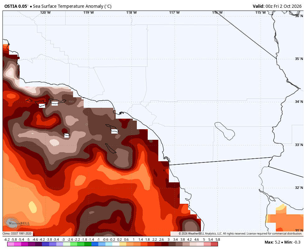
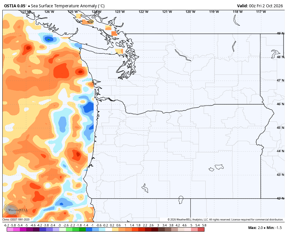
This surge of warmer waters will slowly keep going north at roughly 5-6 mph — about the same speed as a Los Angeles commute 😅 — and it’ll eventually arrive off the Washington Coast later this month.
With this historic El Nino’s warming engine set to keep going for several more weeks to come, these Kelvin Waves will remain frequent through the fall and winter.
WHY DOES IT CAUSE CONCERN?
That added undersea surge of warm water along the Kelvin Wave will push against the coast, bringing a gentle rise in sea levels as the extra added water volume has to go somewhere.
In this case, sea levels are expected to rise off the California coast of about 6 inches — roughly the height of an iPhone. It’s expected to be a little less up here in the Northwest as the wave fades a little with distance.
Why would a paltry 6-inch rise in sea-level be a problem? A vast majority of the time, it isn’t. But it can be a force multiplier when combining with other factors temporarily rising sea levels, such as during periods of high astronomical tides or significant Pacific storms… or in worst case scenarios: both.
Southern California in particular fits the bill because they are susceptible to other frequent impacts of this historic El Niño: A supercharged eastern Pacific hurricane season, and the looming predictions of a relentless jet stream that will bring frequent strong storms through Southern California later this fall and winter.
Already with major Hurricanes Marie, Polo and Genevieve that swirled off northwestern Mexico this summer, Southern California has faced intense high surf that has caused damage to waterfront properties and enhanced beach erosion.
The hurricane season still has another several weeks to go, and now we’re adding another 6” rise to the water levels that will only enhance the impacts from high surf.
Strong Pacific storms also generate high surf, while periods of lower atmospheric pressure near storm centers can “pull” at the water surface, temporarily raising sea levels more. And there’s a few periods of “king tides” coming up this fall and winter that will mean high tides will be higher than normal.
So if Southern California manages to combine a period of high surf from a storm or offshore hurricane with a period of king tides on top of an ongoing Kelvin Wave, what seemed like a paltry 6” rise in sea level will instead make the event more impactful and damaging. So that is the cause for concern.
WHAT ABOUT HERE IN THE NORTHWEST?
Those along the Washington (and Oregon) coast and the Olympic Peninsula would theoretically have similar concerns though we don’t have to worry about the El Niño supercharged hurricane season-induced surf.
We could feel some additive impacts from the Kelvin Wave during those periods of king tides — especially if it happens to coincide with a strong Pacific storm and its high surf and lower atmospheric pressure. King tides are expected around Thanksgiving week, Christmas week, mid-late January and mid-late February.
Strong El Niños typically keep the storm track farther south in the winter — bad for accumulating snow and rain, but theoretically good in avoiding stormy weather during those anomalous high tides and a Kelvin wave event on top.
But even if those events align, any impacts would be localized to the immediate coasts and shorelines where coastal flooding has been an issue in the past. If you don’t live where coastal flooding is an issue, like much of the Seattle area, then Kelvin Waves are no direct worries. (The heated waters can have an impact on marine life though, so that could have secondary impacts on fishing.)
ARE KELVIN WAVES NEW?
It might feel like “Kelvin Wave” has become 2026’s Media Meteorology Word Of The Year, just like “Polar Vortex” and “Atmospheric River” in years before them.
Kelvin waves have been known about for decades and have been a “feature” of past strong El Niños. But with this particular El Niño shattering records for heat and intensity, the corresponding Kelvin wave is stronger than usual.
It’s named for Lord Kelvin (William Thomson), who was a British physicist in the late 1800s and a pioneer in coastal wave theories. If the name sounds familiar, he’s also the same name behind the Kelvin temperature scale, which is based off the same scale as Celsius but sets zero degrees as Absolute Zero, which is -273 degrees C.
(I’m surprised no media sites have picked up on this totally legit headline for Los Angeles during their current heat wave:
“Temperatures reach a record 312 degrees Kelvin in Los Angeles as Kelvin Wave arrives” 😉)
HOW LONG WILL IT LAST?
The Kelvin Waves look like they will be a part of our coastal life through the duration of this historic El Niño event, likely fading in the late winter or spring.
I’m sure some are already scouring meteorology glossaries looking for 2027’s new word. Don’t forget: “Bomb Cyclone” has already been taken. 😉