How ensemble models can help solve the mystery of will it rain this weekend in Seattle?
 Scott Sistek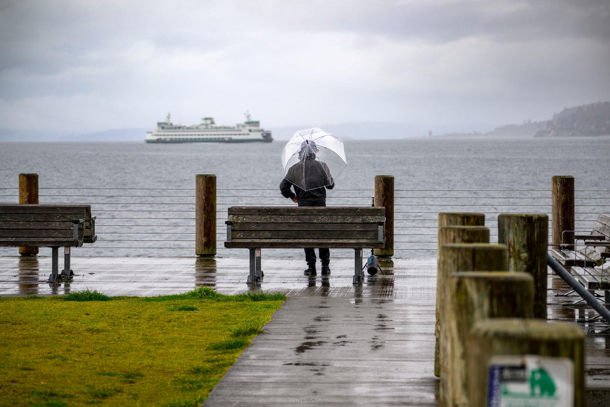
Photo: Tim Durkan
What to do when the workweek ahead is essentially weather-drama free?
Look at the weekend — you’re sure to find some weather drama there.
(….)
FOUND IT!
All right, so it’s not high drama but this weekend forecast will instead give me the opportunity to let you peer behind the scenes in some of the latest forecast model advancements — namely how relatively new ensemble models can help in the long range forecast.
For now through Friday, there’s nothing exciting — we’re locked in a steady, pleasant pattern of light to moderate ocean breezes that bring varying amounts of morning clouds and then sunshine with highs in the upper 70s. We will still at times keep somewhat of a wildfire smoke haze through the week but it should stay aloft.
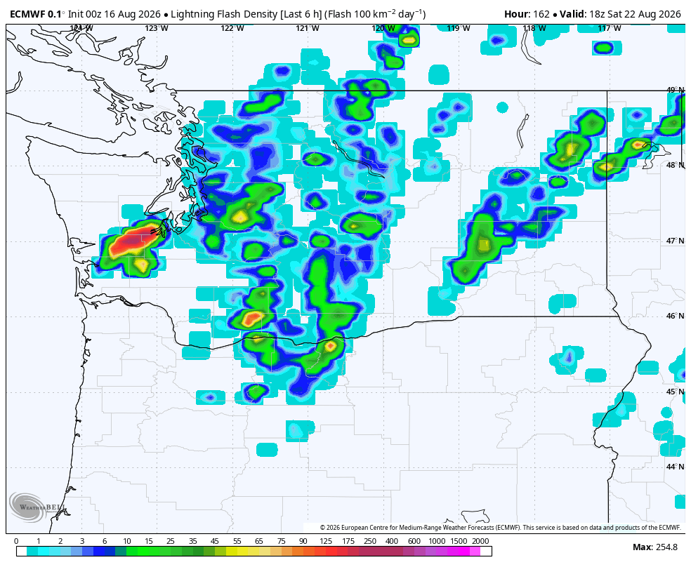
Then a forecast model Saturday evening showed BIG rain for Seattle next Saturday as a monsoon plume moves through with lots of lightning!
Almost an inch of rain in the heart of Puget Sound! (0.88” in Seattle) Summer weekend: Washed out!
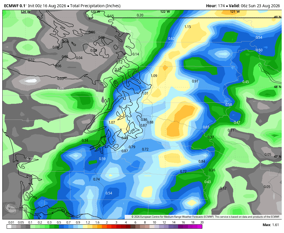
It would rank among the Top 15 wettest August dates on record.
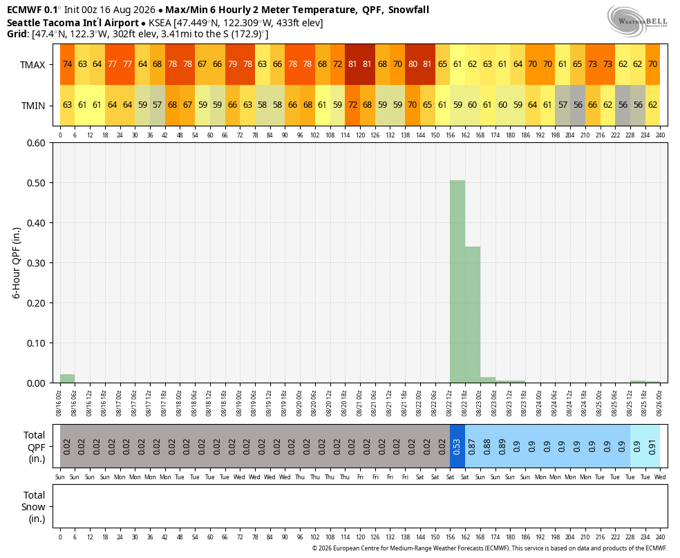
WHOA, NOT SO FAST!
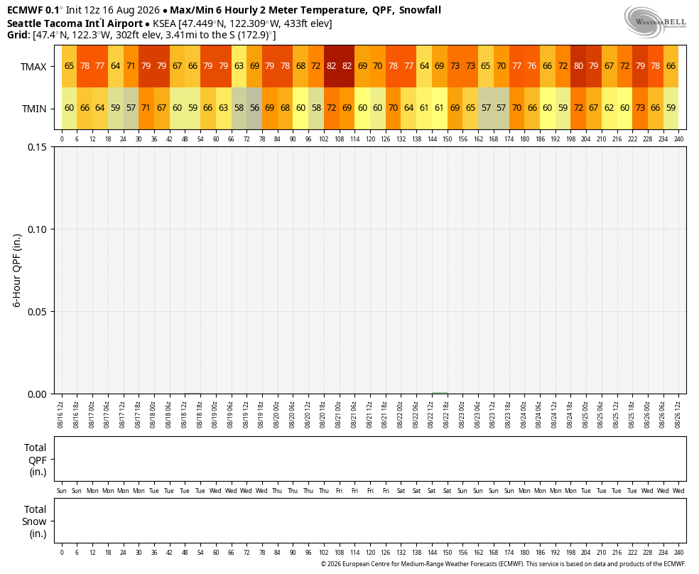
BUT then Sunday morning’s run of the SAME model for the SAME forecast time predicted… 0.00”—
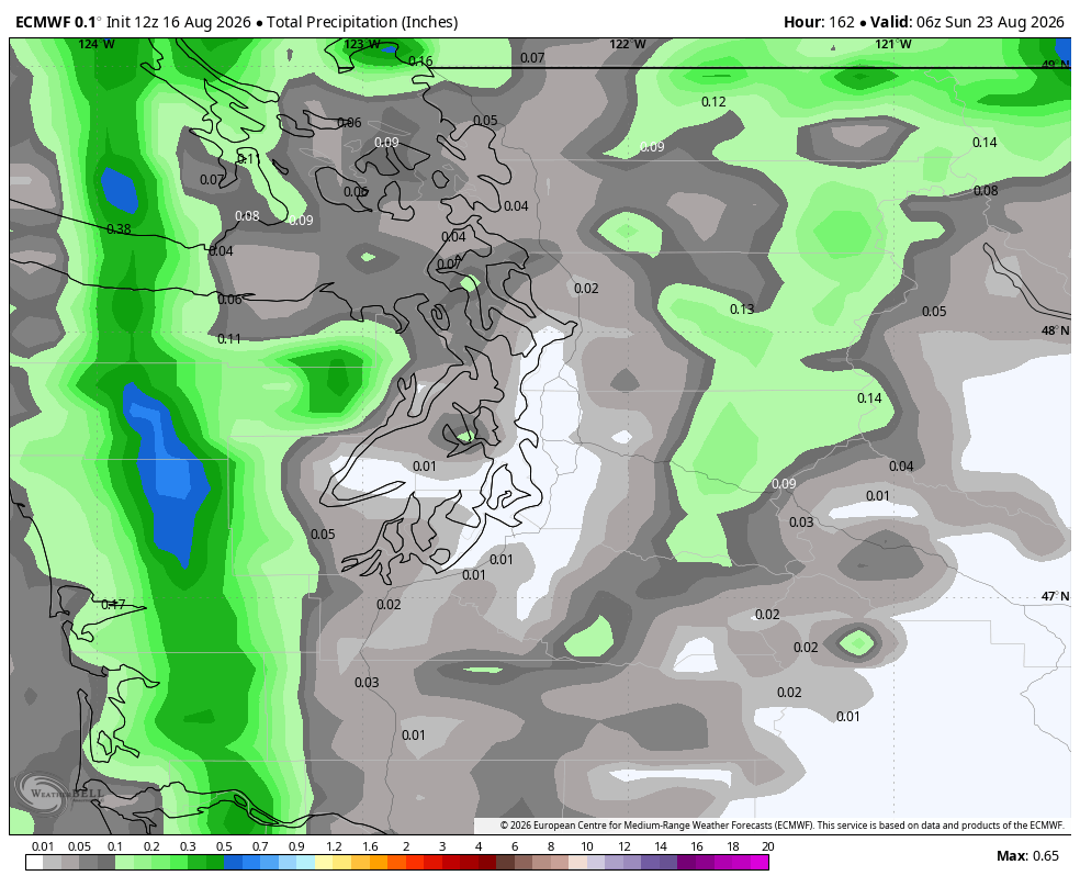
Bone dry not just the entire weekend for Seattle, but for the entirety of the next 10 days.
Old days, we’d be like :/ but now we have ensemble models that run dozens of version of the original model with slight tweaks. If most of the solutions come up nearly the same then you’ve got pretty good confidence the models are on the right track. If they don’t agree, then it’s easier to spot model errors.
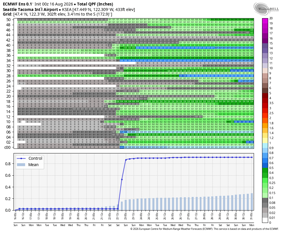
In the overzealous model’s case, looking at the ensembles show the 0.88” is an extreme outlier, and thus very unlikely at this point. Of the 50 ensemble runs, only 21 show 0.10” or more, and of those, only *3* showed a half inch or more, and none as high as 0.88”.
The average of the ensembles comes out to about 0.10” to 0.15” — still indicated potential for some rain but not high confidence and likely not a washout or a torrential downpour.
AND THEN ON THE FLIP SIDE…
Then that Sunday model run that showed 0? Well, it *too* was the outlier. Only 4 of the 50 model runs from that batch agreed with main model showing 0 rain. This time 23 out of 50 showed 0.10” or more. Much like the last time, only 3 out of 50 showed 0.50” or more. The average? About 0.10” — similar to the earlier run.
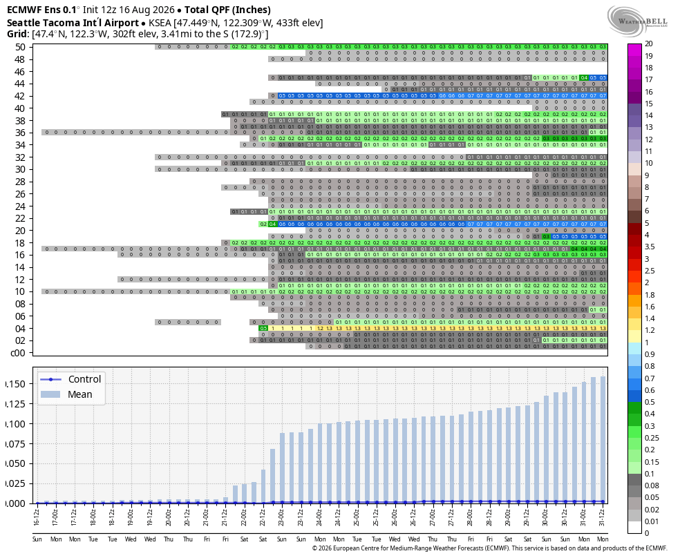
So the ensembles paint a picture of a low to moderate confidence of light rain showers in Seattle on Saturday, as opposed to if you just looked at the main model run, your data points are near-record washout or bone dry. And it’s not just rain; it works for all forecast variables — wind, temperature, dew point, etc.
Yay, science!
SO AFTER ALL THAT: IS IT GOING TO RAIN ON SATURDAY THEN?
It’s a solid… MAYBE! The ensembles give us several iterations that it could happen, so we’d say there is at least some chance. But probably not a lot if so.
RAIN IN LATE-ISH AUGUST? NOT UNUSUAL…
Ironically, August 22 is just about when Seattle starts to shake off the bone dry season like a stubborn piece of double-sticky tape and starts the slow cadence of bringing in some occasional rain.
If you look at the percent of years it’s rained on any given date; the nadir is about 10% in late July/early August. But that figure has a notable jump to about 25% right about starting on… you guessed it… August 22.
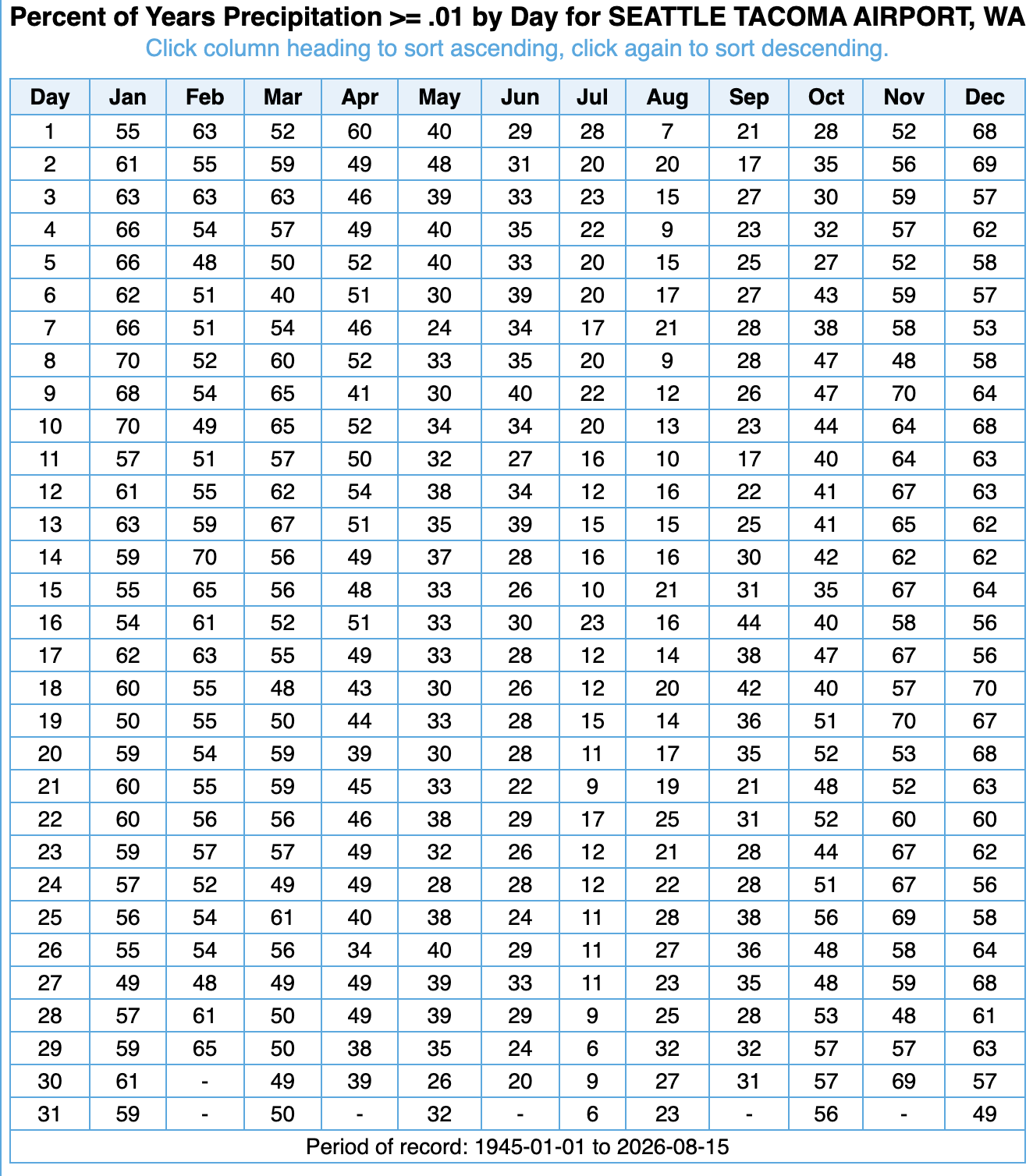
We actually hang around that 25% mark through late September — eking into the low-mid 30% range by the end of the month. Then the numbers take off around October 7. Somehow our wettest day of the year and peaking on the rain chart is November 19.
WHAT’S UP WITH THE SMOKE?
Looking at the latest smoke models, it doesn’t seem like these latest marine pushes are carrying enough upper level wind to really scour us out. It’s helping, but not a full cleansing wind.
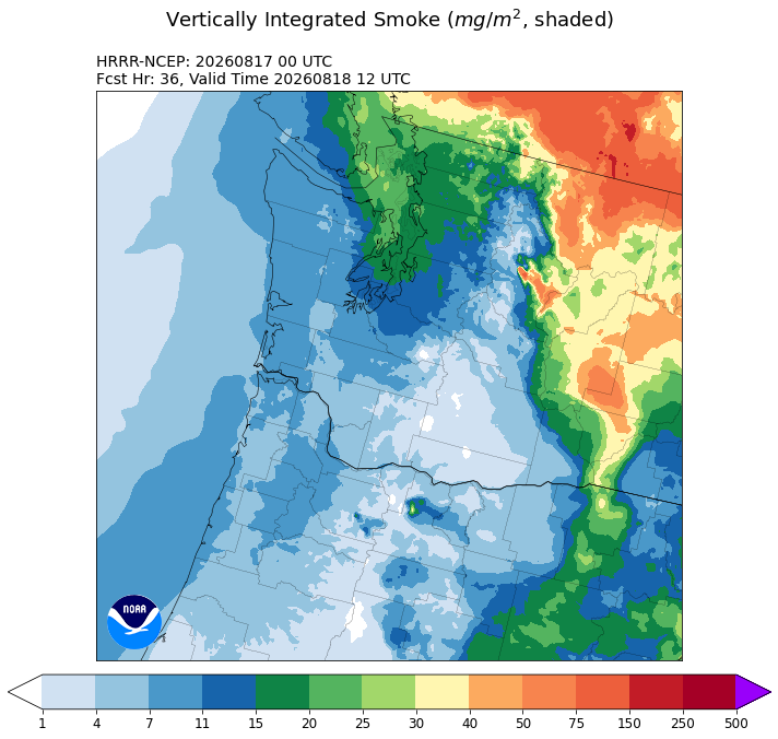
So it looks like we’ll keep a minor haze at times after the morning clouds burn off but air quality should remain good.
MORE: Seattle heat and smoke forecast: Next weekend trending in the wrong direction
DID HAWAII REALLY HAVE A HURRICANE AND SNOW ON THE SAME DAY?
Hard to believe, but yes.
It’s happening. Hurricane Lala is currently producing SNOW on the summit of Mauna Kea pic.twitter.com/kwz1RNm0Yl
— Greg Diamond (@gdimeweather) August 16, 2026
It snowed atop Mauna Kea — though their summit is nearly as tall as Mt. Rainier so that’s not too unusual, but is unusual in August especially when accompanied by a warm tropical system and 100+ mph wind :O
CAN IT SNOW WITH A HURRICANE IN SEATTLE?
No. But our Cascade summits have 100+ mph (non-hurricane-generated) winds during wind storms that also bring snow to the higher elevations.
MORE: 134 mph gust reported atop Alpental Summit while Seattle gets its strongest gust in months