Lightning and wildfire smoke become unwanted guests in the forecast for Washington
 Scott Sistek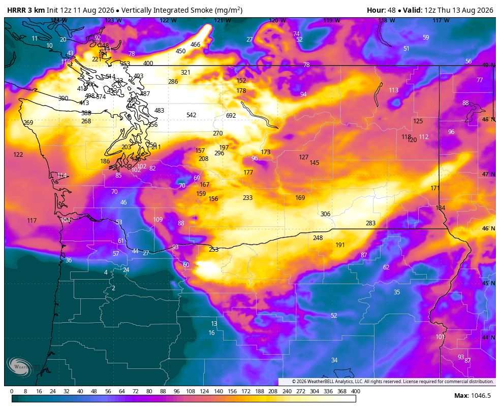
HRRR-Smoke model showing vertically integrated smoke column forecast (as in aloft + ground) for Thursday morning. Most of this smoke shown for Western Washington is aloft.
After a nice several day break from weather mayhem in the Northwest, a few wrinkles have returned to the forecast this week that may bring some lightning to the mountains…and some smoke back to much of the rest of us.
Tuesday’s weather is still calm and pleasant with sunshine and seasonal summer temps for western Washington.
But a weak trough of low pressure is still set to move through British Columbia Wednesday into Thursday. And while its effects on Seattle and the Puget Sound area’s weather will be minor, it will have some unwanted impacts elsewhere.
THE LIGHT SHOW NO ONE WANTS…
Forecast models are still fairly consistent that this system is too weak to bring much of any rain or lowland precipitation, so for much of Western Washington, including the Seattle/Puget Sound area, it’s just a few extra clouds and shaving a few degrees off our high temperatures to the low-mid 70s.
But the trough IS expected to bring enough atmospheric instability to trigger some thunderstorms over the northern mountains. That would include the Northern Cascades south to about Snohomish County, the Okanogan Mountains in Eastern Washington (really, anywhere about the northern 1/3rd of Eastern Washington) — and possibly the Olympic Mountains too.
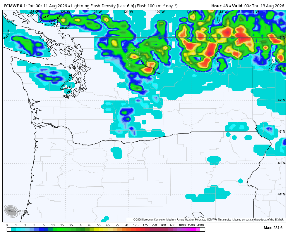
The thunderstorms themselves don’t look too intense or severe, but right now any lightning strike is an unwanted lottery ticket to sparking a new wildfire with the widespread parched conditions across the state. We’ll just have to cross our fingers that we make it through these storms without more fire starts but the odds are… not good.
SMOKE MAY RETURN TOO FOR WEDNESDAY AND THURSDAY
Most of our smoke in Western Washington has come via the heat waves and ensuing offshore winds blowing the smoke in from Eastern Washington. But this time it may be the opposite culprit — a low pressure center.
The short term smoke forecast models are indicating that smoke will “wrap around” that low center as it moves through B.C. and push some of the smoke from the fires burning in southern B.C back to the southwest — and into Western Washington.
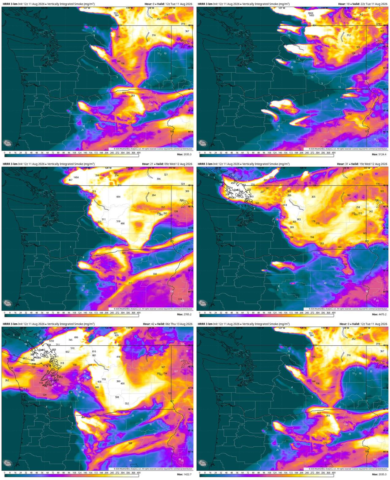
MORE: Here is how to find and read wildfire smoke forecast models for Seattle and the U.S.
The good news is this smoke looks to remain aloft as it’s traveling from a far distance – the models don’t show much on the ground in Western Washington, so our air quality should hold OK. Instead, midweek may be a hazy mix of marine/regular clouds, and high altitude smoke obscuring our peeks of “blue” skies.
WHAT ABOUT CENTRAL AND EASTERN WASHINGTON?
Amid the lightning chances Wednesday, Central Washington too may see an increase in smoke thickness and coverage as some of the winds from the low push smoke back southwest/west toward the mountains and it dams up against the foothills.
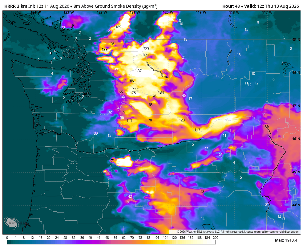
As of now, the models indicate this doesn’t look as bad or as hazardous as last week, but looks like poor air quality may be a factor again.
IS IT STILL SUPPOSED TO GET HOT AT THE END OF THE WEEK?
There is some good news in that the forecast models have backed away from hotter weather toward the end of the week and weekend that was hinted at in earlier model runs over this past weekend.
Instead, it seems like we’re going to go into a somewhat stagnant pattern for Friday into early next week with light winds both aloft and on the surface (save for afternoon and evening sea breezes near the water.)
For temperatures, this should be manageable with highs generally in the low 80s around Seattle with maybe brief morning clouds near the water. Eastern Washington would be close to seasonal summer heat with light winds too.
As far as smoke goes, it appears to be a trade-off: The light winds should keep us from importing any new smoke, but may also be slow to clear any smoke that makes it in here mid week.
So I could see a scenario where it remains smoky/hazy aloft in Western Washington through next weekend, but still OK air quality on the surface.
Eastern Washington near the Cascades may still remain problematic if the winds totally fizzle end of next week.
(TL;DR: “Too Long; Didn’t Read” synopsis: Weather system heading into B.C. Wednesday presents a chance of thunderstorms for the Northern Cascades, Olympics and northern Eastern Washington that may start new wildfires. High altitude smoke may blow back over Western Washington as the storm passes midweek, and may stick around through the weekend, though air quality so far seems like it’ll hold.)