Seattle could see more thunderstorms Saturday as cold trough sweeps through
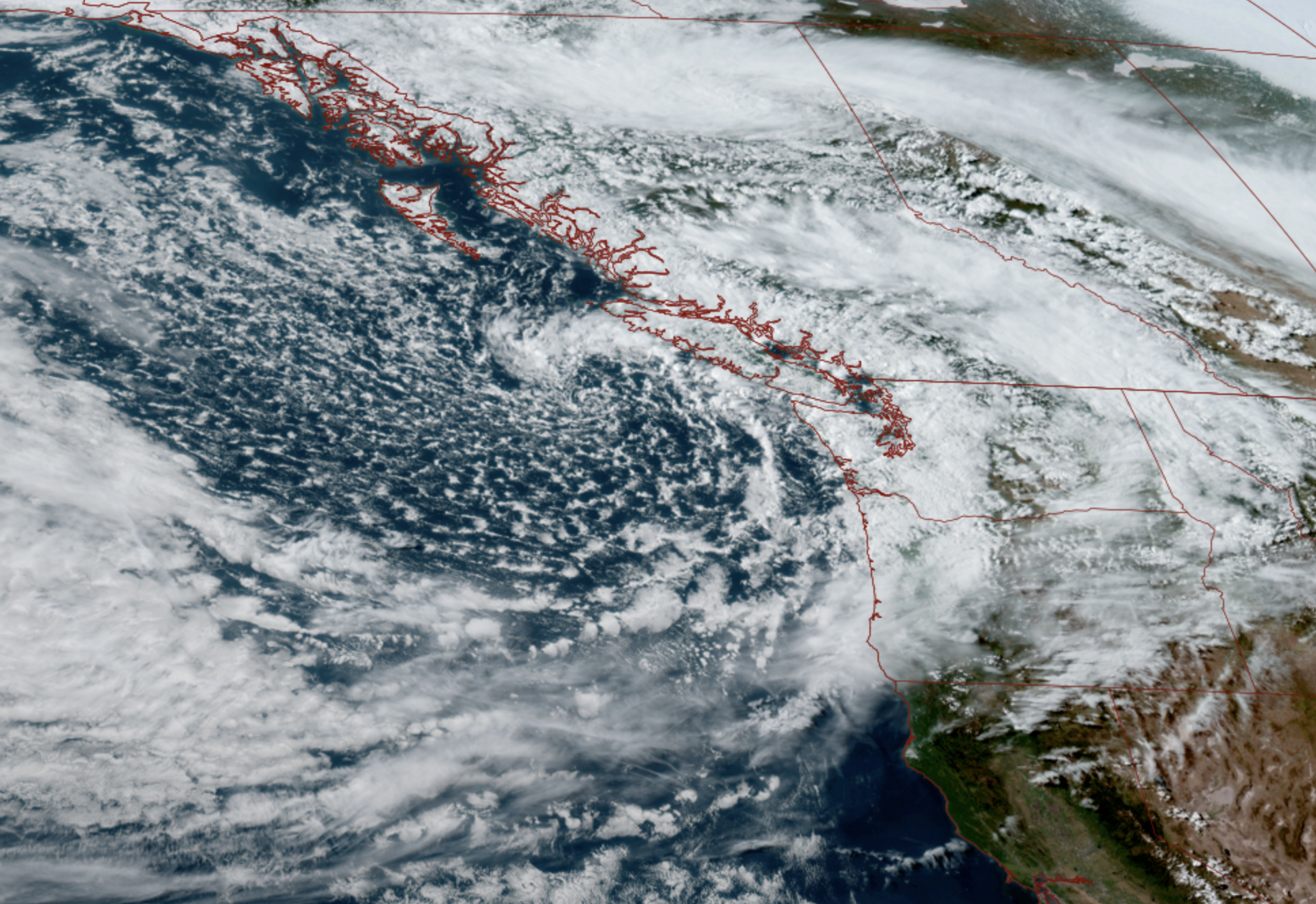
GOES 18 satellite image for May 15, 2026 showing a cold swirling low pressure center just to the Northwest of Washington. (NOAA / CIRA / RAAM-B)
Seattle doesn’t always drink from thunderstorms. But when we do, we prefer “dos mes”: April or May
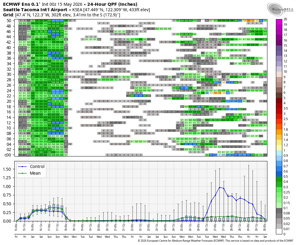
We are in the heart of what passes for thunderstorm season around here, which usually means maybe a few isolated days of a thunder risk, as opposed to the much more frequent “not a chance” days. Officially, Seattle averages somewhere around 5-7 days with reported lightning a year.
Wednesday and Friday’s risk days didn’t amount to much, but Saturday is looking like perhaps the best chance of the three days as the air mass is cooler and more unstable.
Another very chilly trough of low pressure is dropping in from the southern Gulf of Alaska Saturday on the heels of today’s trough. This will mainly have the effect of keeping rain in the forecast through the day Saturday.
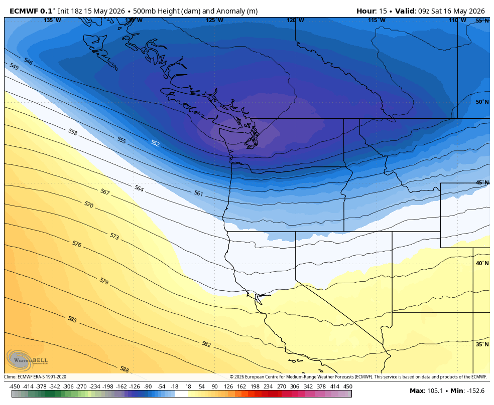
But as cold air moves in aloft, that allows warmer air parcels from the ground to lift higher, allowing for taller clouds and stronger storms and, yes, a chance of graduating into thunderstorms. That’s what’s known as an “unstable” atmosphere.
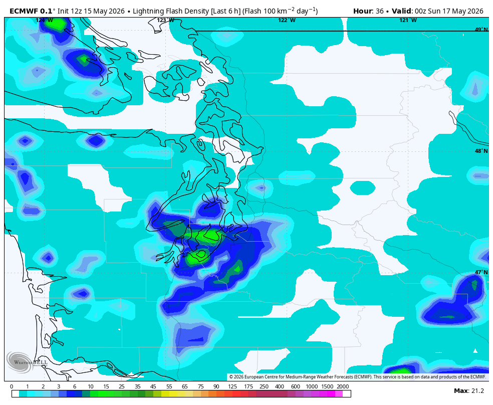
Aside from the flashes of lightning and booms of thunder, these storms could bring small hail and brief heavy downpours — with big raindrops; not those puny ones that barely escape “drizzle” classification. So keep an eye to the skies and your radar app if you’re going to be outdoors — this time the weather is coming from the west/southwest (unlike Wednesday’s which was coming from the south/southeast)). Right now looks like the best chance of storms are from about Seattle and points south.
It will also keep the day cool and breezy with highs again in the low-mid 50s. Friday’s chill nearly set a record for coldest high temperature but May 15th’s record “low-high” was 49 degrees – though surrounding date records are in the low 50s.
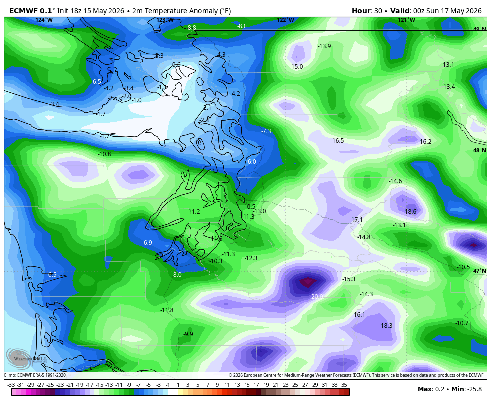
And yes it IS cold enough to be snowing in the mountains. A Winter Weather Advisory is up until 8 a.m. Sunday for 4-6” above 4,000 feet. The passes should be OK since the road temps are warm; but the National Weather Service admits the advisory was more to give a heads up for anyone going hiking or climbing or camping that they need to prepare for possible wet snow and occasional lightning. (Spoiler alert: It does get better on Sunday.)
But once this low moves off to the east, our weather nicely rebounds as if Goldilocks has her eyes back on the cabin in the woods (what? Read my earlier forecasts 🙂 ).
That rebound begins Sunday which is looking dry and pleasant with highs in the low 60s. Really much of next week right now is holding pretty nice again with varying morning clouds but extended periods of sunshine and comfortable temperatures in the 60s – maybe ekeing back into the 70s later in the week.
How is Memorial Day weekend looking? So far it’s leaning dry on Saturday and the long range ensemble models are picking up a little signal of some potential showers later Sunday and/or Monday with Monday looking the likeliest at this point.