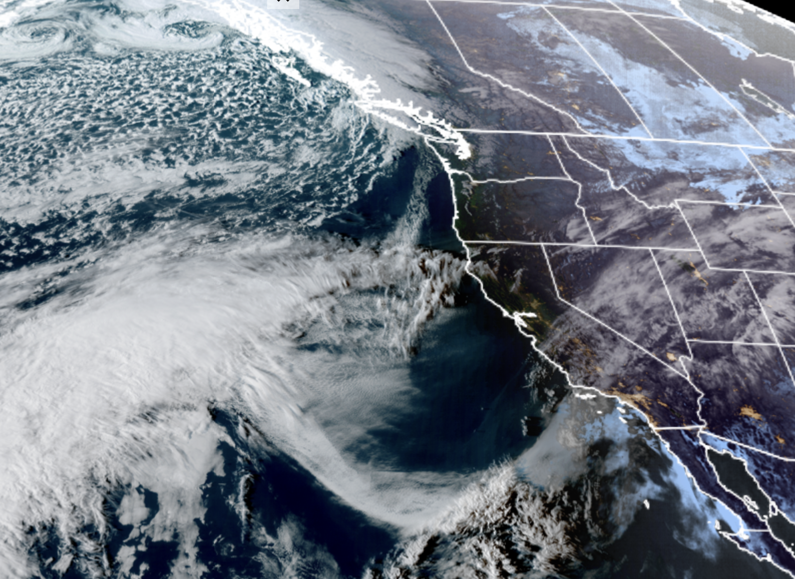
GOES-18 satellite image from March 21. LOOK... not much around the NW! :O
(…at least around here.)
Between Hawaii’s historic rainfall (still going on) and the historic Desert Southwest heat dome (also still going on) and our multiple-day atmospheric river in the Pacific Northwest (finally… at least that one’s over) you can’t be blamed for thinking the weather has been essentially broken across our section of the hemisphere.
But at least for Seattle and Western Washington, March is going to start looking a lot more like… March.
First of all, our flooding rivers have crested and are working their way back down now that the heavy rains are done.
Instead, Saturday turned into quite the pleasant day and we’ve got a pair more of similar reasonably sunny and comfortable days on Sunday and Monday too with highs in the 50s. I was at the Everett waterfront for a while today and it was very busy with everyone racing out to get into the sun.
But Sunday and Monday both — great days for walks or hikes or jogs or eating lunch on a park bench.
Tuesday? No.
A more traditional Pacific storm will roll through the area, making for a rainy and windy day. The storm center is looking rather strong, especially for mid-March, and it’s going to look really amazing on the satellite image.
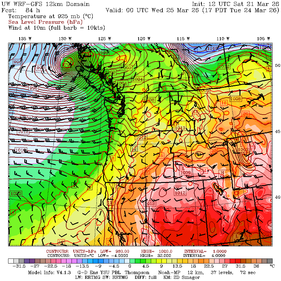
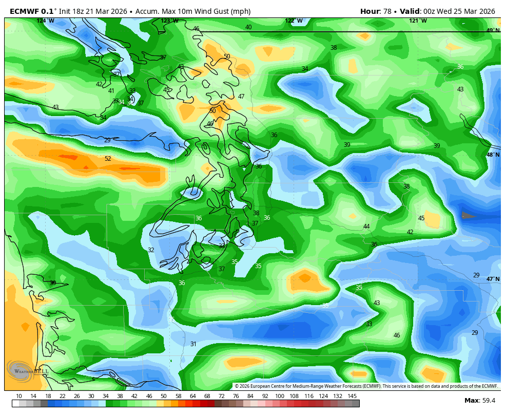
But it is forecast to make landfall well to our north — even a bit north of Vancouver Island. So far enough away that the wind isn’t looking too impactful but close enough to be noticeable. The Euro model has gusts about 35-40 mph around the Puget Sound area.
But it’s another round of rain and high-mountain snow. It won’t be as warm or wet as this week’s dayslong atmospheric river so we don’t expect any renewed flooding, and it at least put back a little of the snow lost this week.
There are some signs another weaker but cooler system will sneak in on that storm’s heels Wednesday and Thursday, knocking snow levels down to about 2,000-3,000 feet. This isn’t a very wet system but frankly, getting any kind of snow in the mountains is a win considering the 2-week-long bake sale that’s destroying that meager snow pack was left across the rest of the West.
We look to dry out toward the end to the week and next weekend is looking pretty pleasant too.
HEAT DOME: STILL GOING….
As mentioned, Washington is about the only place in the U.S. West that has been immune from the heat dome, thanks to being just far enough away from its furnace, and instead being under the influence of the (relatively) cooling storm track.
While the historical peak of the heat dome is set to fade, it is still going to remain very potent through at least next week, to where it’s starting to feel more like this isn’t just a passing event and instead, summer has really started two months early.
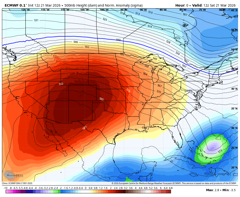
While Phoenix’s forecast is coming down off just a little off the 105’s that torched their record books both in observed temperature and duration, it is still going to remain record-hot for at least the next week. Phoenix’s last four days have been 102, 105, 105 and 105. The forecast the rest of this week is 102, 99, 101, 103, 102, 103, 101.
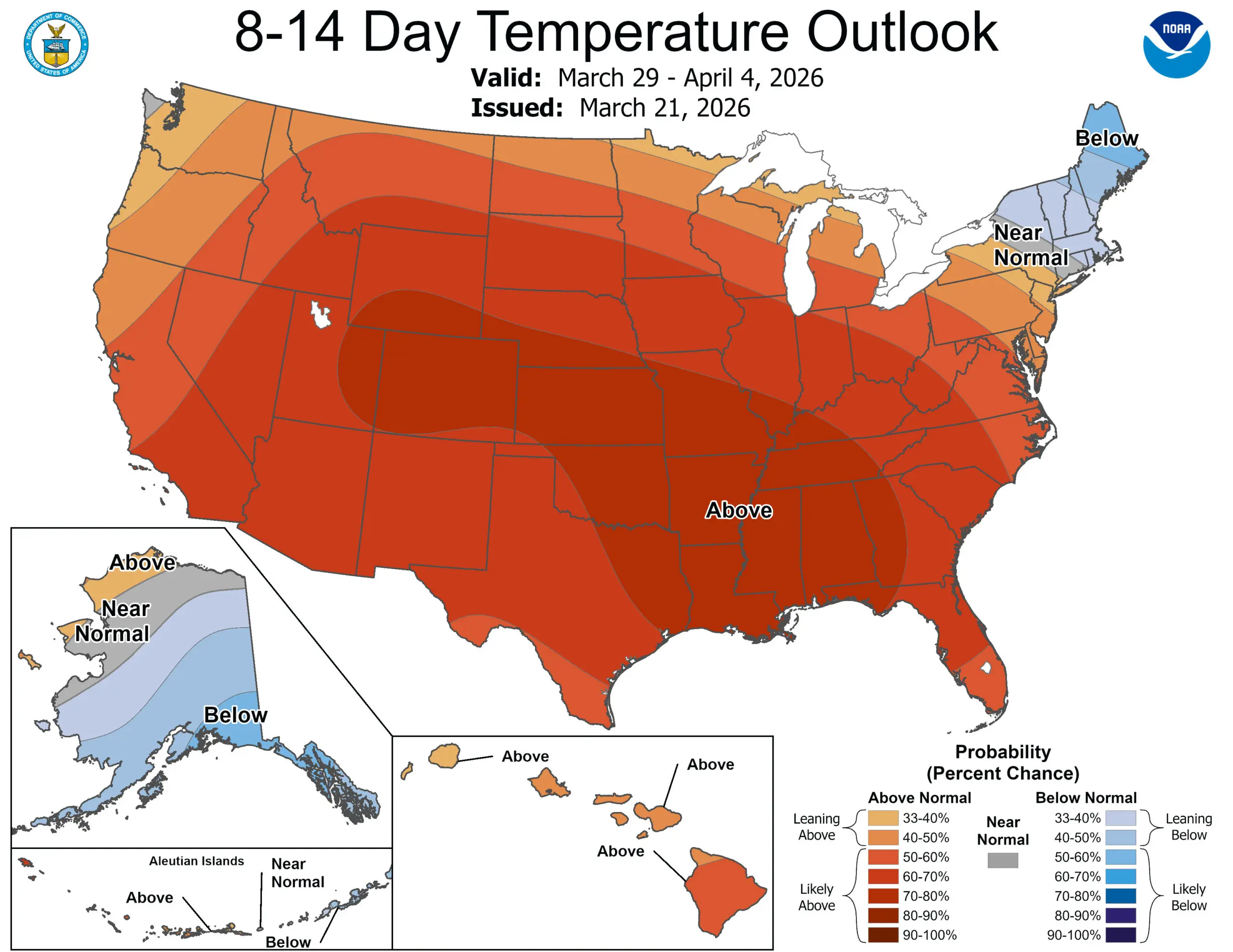
Remember before this week, Phoenix had hit 100 degrees in March one time since 1933. That March record will now drop to 11TH PLACE by the end of next week — yes that record will be smashed 10 times in 11 days. And if you look at the 6-10 day outlook, you can see the heat dome is STILL THERE in the Southwest… and thankfully still not quiiiite reaching up to our area. And then by the 8-14 day outlook, it appears our sprawling heat will morph to the east and start baking the Plains and Southeast too.
And Hawaii can’t catch a dry break either with a second Kona Low soaking the islands again. Oahu has had 8-12” in the lowlands with some of the mountain peaks getting feet of rain. The 6-10 and 8-14 day outlooks maintain wetter than average conditions there.
Meanwhile, it’s been literally the polar opposite in Fairbanks. The average high temperature in Fairbanks in March so far is 0.8. Their coldest March average high temp on record (for the entire month) is 7.6.
Average low? -30.6 That is nearly 10 degrees colder than their record cold March. They’ve had 7 days with lows of -40 or colder. They got the rare experience of where the Celsius scale looks warmer than Fahrenheit!
We can only hope some sense of spring normalcy can reach all these other places too.