‘Megaridge’ has become ‘MEGARIDGE-IER’ and sunny streak to last another week
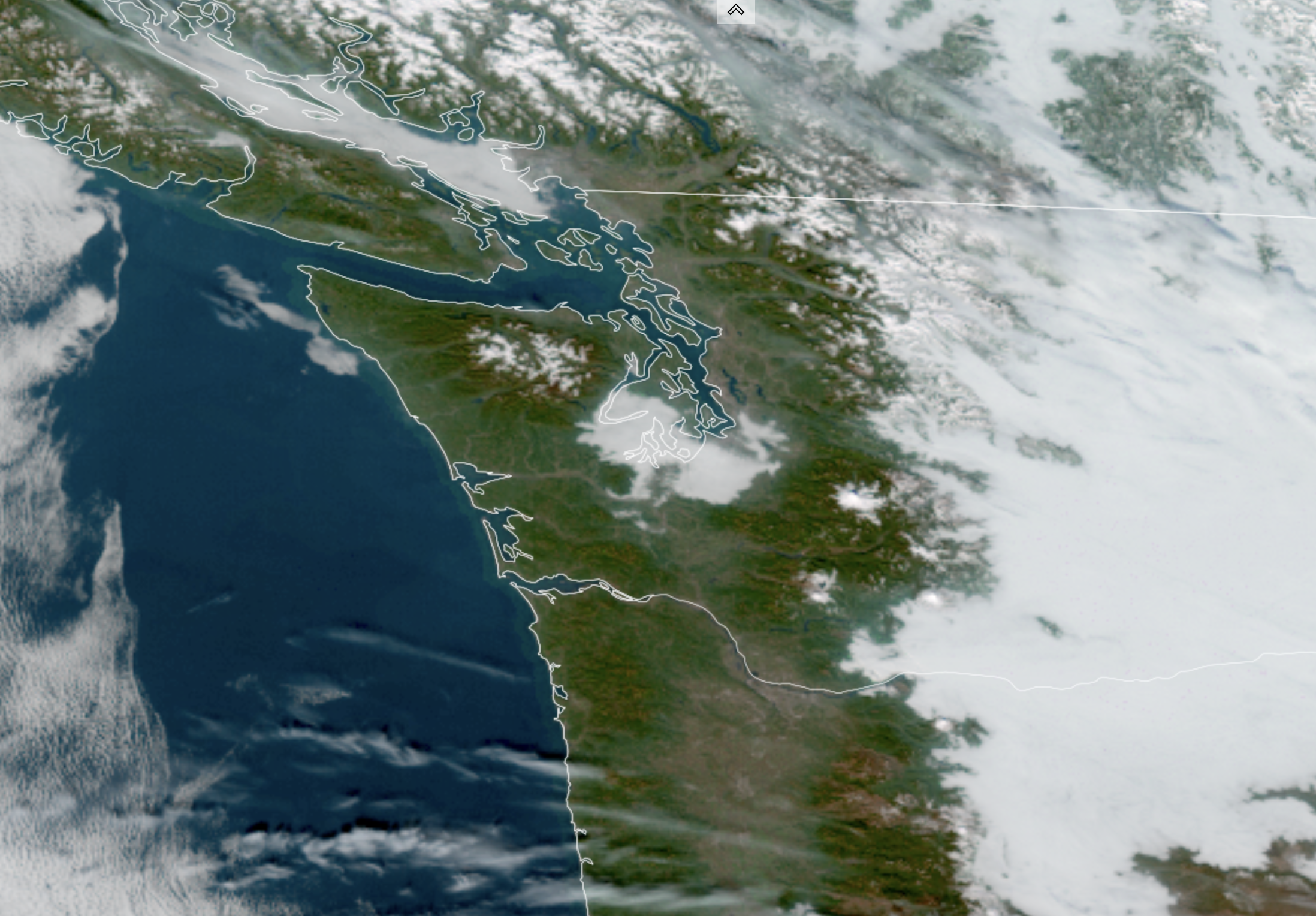
GOES 18 Satellite image for Jan. 21 (RAAM-B / CIRA / NOAA)
It might be tough to believe after all the atmospheric rivers we went through in November and December, but through Wednesday it has been a whopping 9 days since it last rained in Seattle.
We may now be barely halfway through the dry streak :O
I had jokingly called the ridge of high pressure “MegaRidge” but now it’s to the point I think it’s earning capitalization: MEGARIDGE.
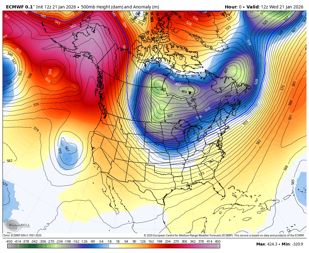
Earlier forecast models had this ridge breaking down around the end of this week, but now it’s found a second wind… actually scratch that, who am I kidding? There’s still no wind…
But rain, such as it was, has now disappeared from the forecast, as an approaching weak front was no match for MEGARIDGE. About the only minor tweak to the forecast is the remnant clouds will float by on Thursday, knocking a few points off our sunshine score. And in tandem, it’ll knock a few degrees off the highs to the low-mid 40s.
Sunshine now returns Friday and looks to hang around all weekend. The air mass is a touch cooler behind this “front” so highs will be in the mid 40s as opposed to around 50 and lows now will drop into the 20s to low 30s for frostier and icier mornings again.
And yes, there will be some places that will see stubborn late night and morning fog that could be freezing fog in the pre-dawn and sunrise hours so be aware there. Otherwise, your only weather impacts are needing some extra time to ice scrape in the morning and watch for slick roads until the sun melts it off.
I don’t know how the Seahawks managed to get two home playoff games in January and have it be clear and calm both games, but Mother Nature says “you’re welcome, 12s”. Just it’ll be chilly again like the last game. The game is staring some 2 hours earlier but the day itself will be a little colder so temps will be in the same range with little, if any wind.
Then, well, I’d say it’s “rinse and repeat,” but it’s just repeat.
Now the forecast models don’t have our next chance of rain until the middle or end of NEXT week — like sometime between next Wednesday and Friday. If that holds that would be an incredible 16-17 consecutive days without measurable rain in January and just about run out the clock on the month :O.
WHERE IS ALL THE WEATHER?
It’s all gone to the East. If your Facebook feed is anything like mine, it’s completely filled with scary maps and graphics with lots of capital letters screaming about this massive and potentially historic winter storm.
Just about everywhere including and east of the Dakotas and Texas and north of Florida has some sort of winter weather watch or warning and more will be hoisted in the Northeast as the weekend gets closer.
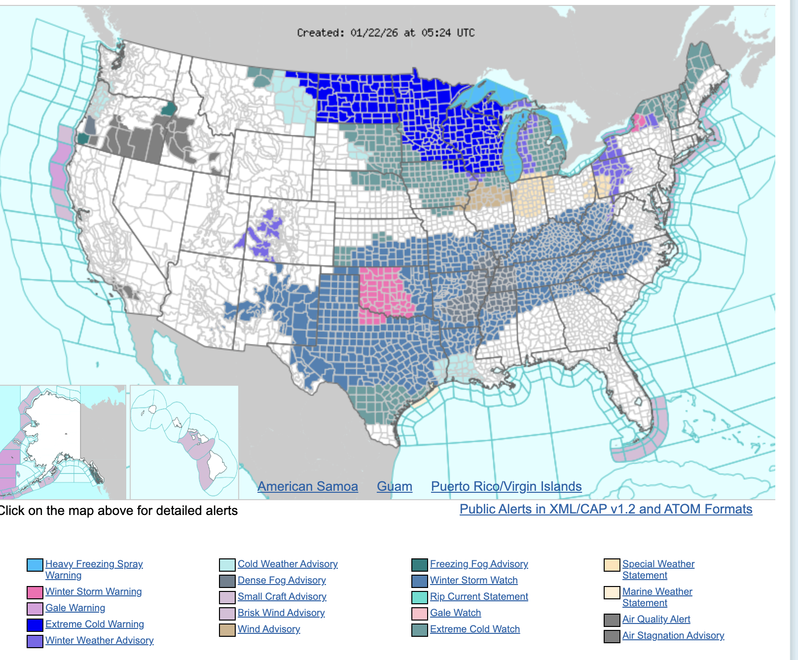
In the South and East it’ll be a mix of heavy snow and thick glazes of freezing rain, along with strong winds. That could include Dallas, Oklahoma City and Nashville before it goes into the Northeast and mid-Atlantic corridor.
In the Upper Midwest and Great Lakes, it’ll be extreme cold with wind chills in the -30 to -50 range in some places. That includes major cities like Chicago, Detroit, Milwaukee and Minneapolis.
If you have any travel plans east of the Rockies through the weekend you need to study up on the weather chaos that may await. (May I humbly suggest Apple News is a great place to start 😉 ) We could see well over half (2/3rds?) of the American population under some sort of Winter Storm or Extreme Cold warning by Friday.
Alas, that does not include any of us in the Pacific Northwest. We are on the weather sidelines. Unless you still count the morning “BO-“ with then afternoon “-RING”.